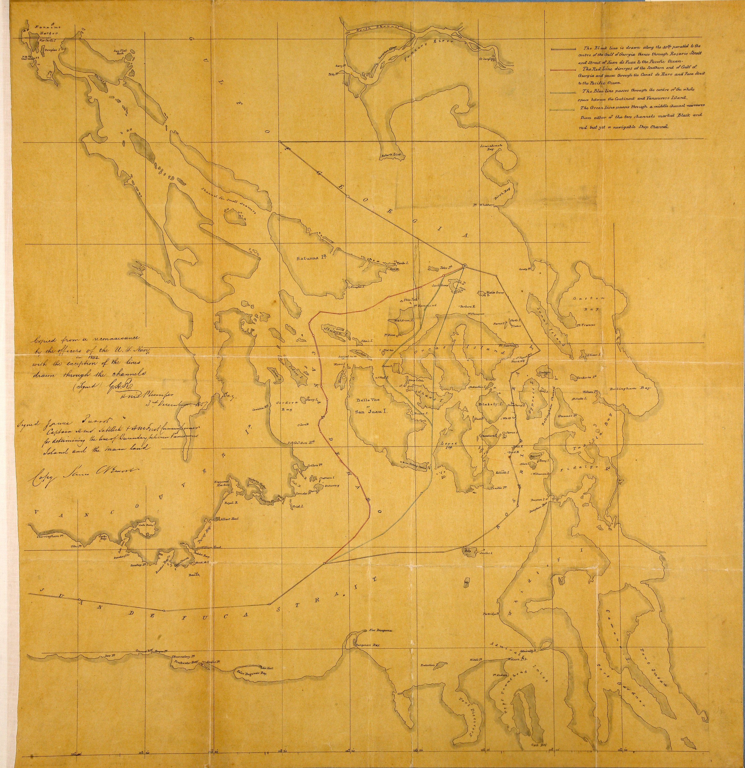
1 item (originally to illustrate 'Memorandum respecting the Island of San Juan') extracted
from ADM 1/5720. Plan illustrating proposals for a boundary between British and United
States' possesions, in the vicinity of Vancouver Island and the mainland around San
Juan Island [now in Washington State, United States of America]. Reference table to
proposed boundary lines. Scale: 1 inch to 3.2 miles (calculated). A note reads 'Copied
from a reconnaissance by the officers of the U.S. Navy in 1854 with the exception
of the lines drawn through the channels'. Initialled by 'G.H.R', HMS Plumper, 3 December
1857 and signed by James [?Prevost], Captain HMS Satellite. Titles supplied by cataloger.
United States Coast Survey,
Plan to illustrate 'Memorandum respecting the Island of San Juan'. Great Britain.
Foreign Office. 1859, 1854-1857, National Archives of the UK, MFQ 1/217.
The Colonial Despatches of Vancouver Island and British Columbia 1846-1871, Edition 2.4, ed. James Hendrickson and the Colonial Despatches project. Victoria,
B.C.: University of Victoria.
https://bcgenesis.uvic.ca/mfq_1-217_1854_1857.html.
Title: Plan to illustrate 'Memorandum respecting the Island of San Juan'. Great Britain.
Foreign Office. 1859.
Title: San Juan Islands and surrounding area.
Author: United States Coast Survey
Subject: San Juan Boundary Dispute, 1846-1872; San Juan Islands (Wash.) -- Maps;
Georgia, Strait of (B.C. and Wash.) -- Maps; Gulf Islands (B.C.) -- Maps; Vancouver
Island (B.C.) -- Maps; Canada -- Boundaries -- United States.
Identifier (repository): MFQ
Identifier (repoNumber): 1
Identifier (repoVol): 217
Identifier (libFileName): MFQ1-217
Identifier (penfoldNum):
Identifier (doc_id): MFQ 1/217
Date: 1857
Funder: Funded by a Canadian Council of Archives, Archival Community Digitization
Program.
Publisher: National Archives of the UK.
Identifier (CONTENTdm): oai:contentdm.library.uvic.ca:collection5/189