Colonial Despatches
The colonial despatches of Vancouver Island and British Columbia 1846-1871
Esquimalt Harbour from HMS Plumper.
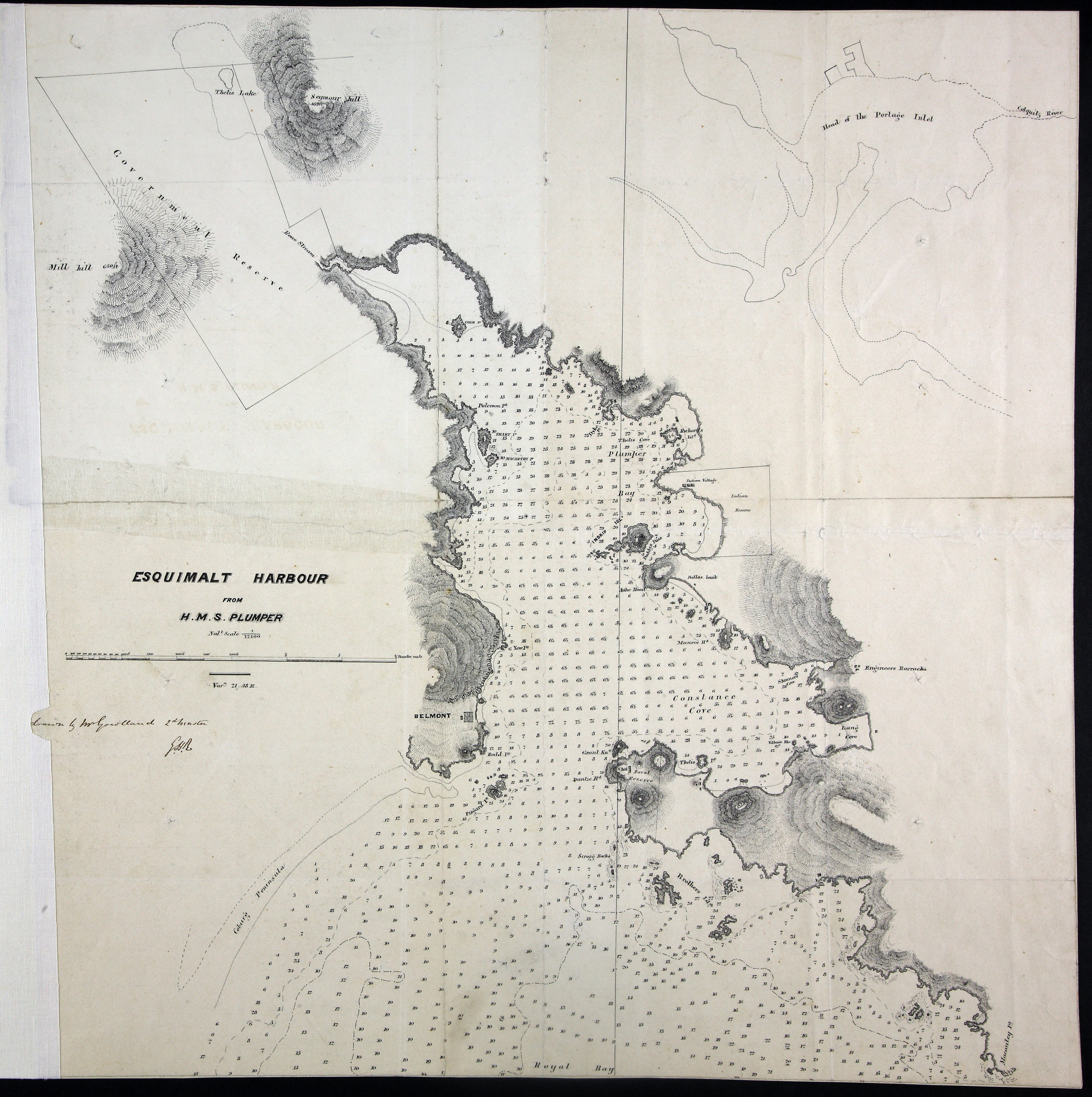
Chart of Esquimalt Harbour, Vancouver Island (now in British Columbia, Canada), from
HMS Plumper, drawn by Mr Gowlland, Second Master. Originally enclosed in a letter
dated 14 November 1859 on the defences of the harbour from Rear Admiral R L Baynes
to the Secretary of the Admiralty. [Esquimalt, 1859]. Relief shown in spot heights
and hachures. Soundings in fathoms. Name of artist in manuscript, initialed
GHR. First Nations reserves and village shown.
Gowlland, John Thomas Ewing (1838 - 1874);, Esquimalt Harbour from HMS Plumper, 1859, National Archives of the UK, MFQ 1/632/2. The Colonial Despatches of Vancouver Island and British Columbia 1846-1871, Edition 2.6, ed. James Hendrickson and the Colonial Despatches project. Victoria,
B.C.: University of Victoria. https://bcgenesis.uvic.ca/mfq_1-632_2_esqui_harbour_1859.html.
Title: Esquimalt Harbour from HMS Plumper.
Author: Gowlland, John Thomas Ewing (1838 - 1874);
Subject: Esquimalt (B.C.) -- Maps; Esquimalt Harbour (B.C.); Nautical charts -- British Columbia -- Esquimalt; Indians of North America -- British Columbia -- Esquimalt.
Subject: Esquimalt, 1859
Identifier (repository): MFQ
Identifier (repoNumber): 1
Identifier (repoVol): 632
Identifier (libFileName): MFQ1-632 (2)
Identifier (penfoldNum): 456
Identifier (doc_id): MFQ 1/632/2
Date: 1859
Funder: Funded by a Canadian Council of Archives, Archival Community Digitization Program.
Publisher: National Archives of the UK.