Colonial Despatches
The colonial despatches of Vancouver Island and British Columbia 1846-1871
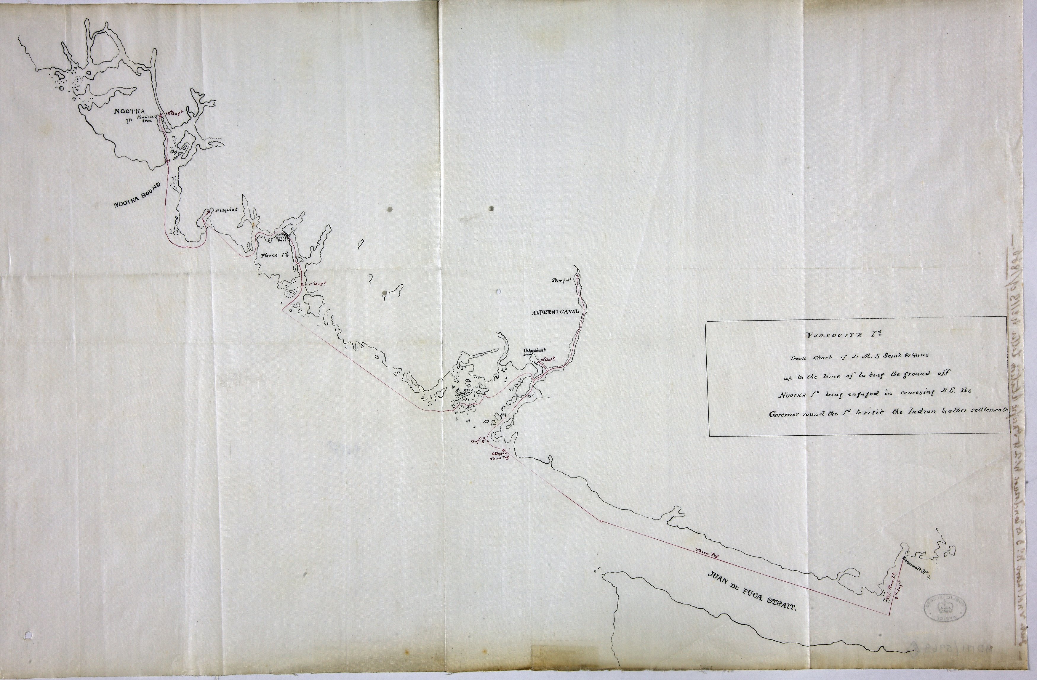
Vancouver Island: Chart of HMS Scout 9-12 August 1866 showing her grounding off Nootka Island while 'conveying H.E. the Governor round the Id. to visit the Indian & other settlements'.
Vancouver Island (now in British Columbia, Canada): 2 copies of a track chart of HMS
Scout 9-12 August 1866 showing her grounding off Nootka Island while 'conveying H.E. the
Governor round the Id. to visit the Indian & other settlements'. The coast and inlets
are also shown in outline. Scale: 1 inch to 10 miles (calculated). Originally sent
with duplicate and original, respectively, of report number 46 dated 23 August 1866
from John A P Price, Captain, and F Townsend, Master, of HMS Scout; subsequently enclosed with letter no 1 dated 5 September 1866 from the Honourable
Joseph Denman, Rear Admiral, Pacific Squadron, accompanying papers concerning the
grounding of HMS Scout.
Vancouver Island: Chart of HMS Scout 9-12 August 1866 showing her grounding off Nootka
Island while conveying H.E. the Governor round the Id. to visit the Indian & other
settlements, 1866, National Archives of the UK, MFQ1-632 (8). The Colonial Despatches of Vancouver Island and British Columbia 1846-1871, Edition 2.6, ed. James Hendrickson and the Colonial Despatches project. Victoria,
B.C.: University of Victoria. https://bcgenesis.uvic.ca/mfq_1-632_8_hms_scout_vi_west_coast_sketch_1866.html.
Title: Vancouver Island: Chart of HMS Scout 9-12 August 1866 showing her grounding off Nootka Island while conveying H.E. the Governor round the Id. to visit the Indian & other settlements
Subject: Vancouver Island; Nootka Sound; HMS Scout
Identifier (repository): MFQ
Identifier (repoNumber): 1
Identifier (repoVol): 632
Identifier (libFileName): MFQ1-632 (8)
Identifier (penfoldNum):
Identifier (doc_id): MFQ1-632 (8)
Date: 1866
Funder: Funded by a Canadian Council of Archives, Archival Community Digitization Program.
Publisher: National Archives of the UK.
