Colonial Despatches
The colonial despatches of Vancouver Island and British Columbia 1846-1871
Somenos District, 1859.
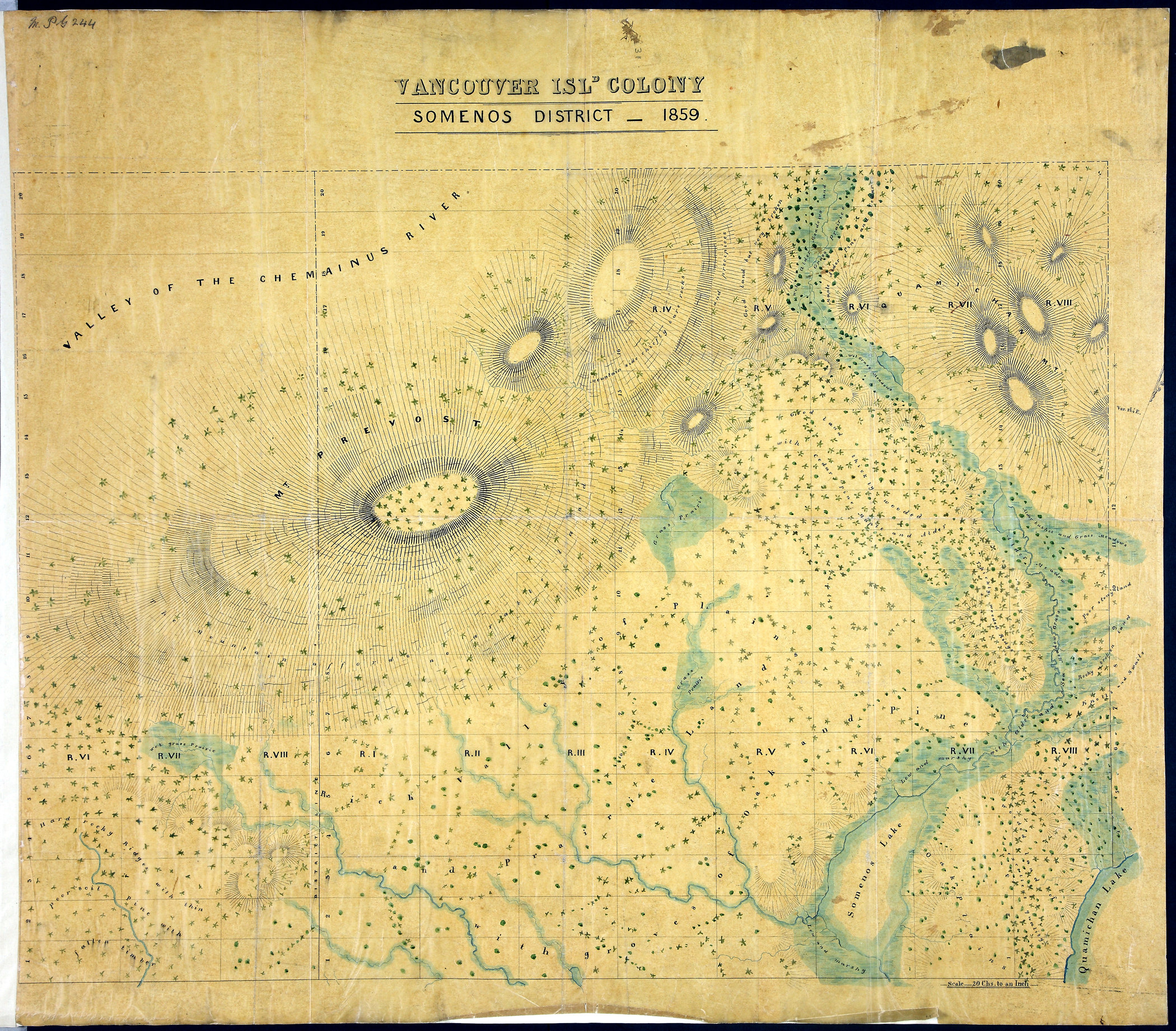
1 item extracted from CO 305/10. Vancouver Island. Map of Somenos District. Scale:
1 inch to 20 chains. [Vancouver Island, 1859]. Relief shown by hachures. Describes
vegetation. Original map produced by the Topographical Depot of the War Office, London,
1859.
Somenos District, 1859, 1859, National Archives of the UK, MPG 1/244. The Colonial Despatches of Vancouver Island and British Columbia 1846-1871, Edition 2.6, ed. James Hendrickson and the Colonial Despatches project. Victoria,
B.C.: University of Victoria. https://bcgenesis.uvic.ca/mpg_1-244_vi_colony_somenos_district_1859.html.
Title: Somenos District, 1859.
Title: Somenos District, 1859.
Subject: Vancouver Island (B.C.) -- Maps; Somenos Region (B.C.) -- Maps.
Subject: Vancouver Island, 1859
Identifier (repository): MPG
Identifier (repoNumber): 1
Identifier (repoVol): 244
Identifier (libFileName): MPG1-244
Identifier (penfoldNum): 569
Identifier (doc_id): MPG 1/244
Date: 1859
Funder: Funded by a Canadian Council of Archives, Archival Community Digitization Program.
Publisher: National Archives of the UK.