Colonial Despatches
The colonial despatches of Vancouver Island and British Columbia 1846-1871
Quamichan District, 1859.
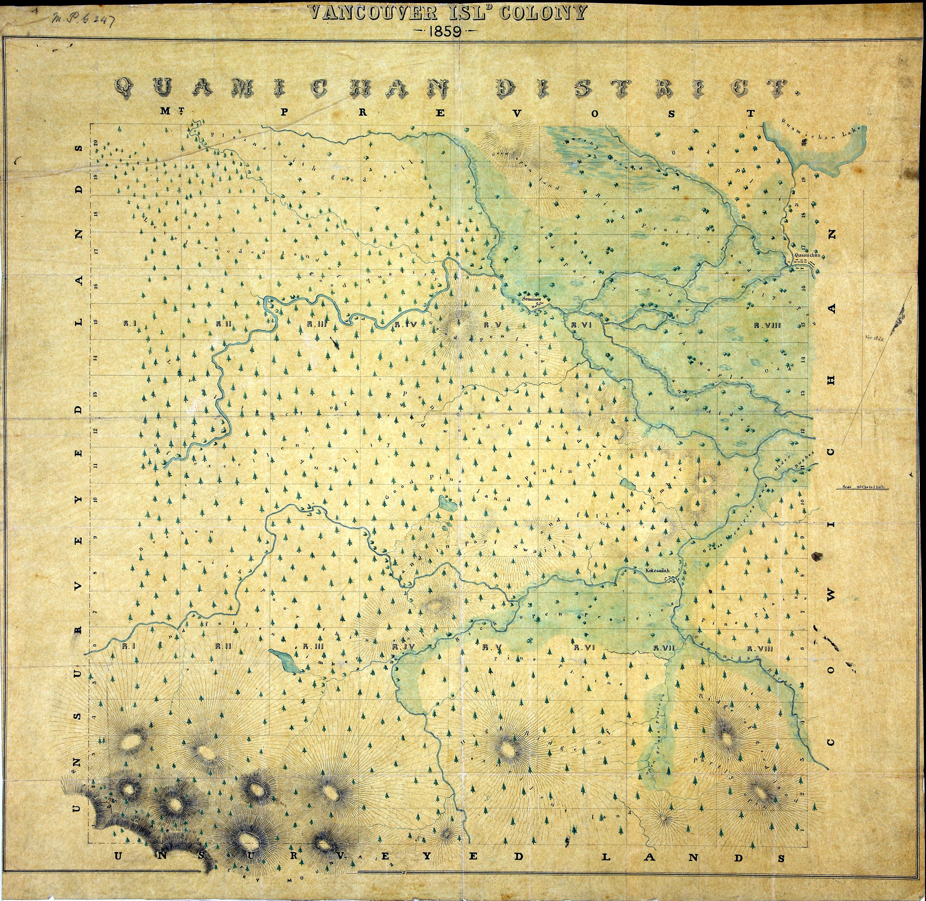
1 item extracted from CO 305/10. Vancouver Island. Map of Quamichan District. Scale:
1 inch to 20 chains. [Vancouver Island, 1859]. Relief shown by hachures. Describes
vegetation and land quality. Original map produced by the Topographical Depot of the
War Office, London, 1859
Quamichan District, 1859, 1859, National Archives of the UK, MPG 1/247. The Colonial Despatches of Vancouver Island and British Columbia 1846-1871, Edition 2.6, ed. James Hendrickson and the Colonial Despatches project. Victoria,
B.C.: University of Victoria. https://bcgenesis.uvic.ca/mpg_1-247_vi_quamichan_district_1859.html.
Title: Quamichan District, 1859.
Subject: Vancouver Island (B.C.) -- Maps; Quamichan Region (B.C.) -- Maps; Land use.
Subject: Vancouver Island, 1859
Identifier (repository): MPG
Identifier (repoNumber): 1
Identifier (repoVol): 247
Identifier (libFileName): MPG1-247
Identifier (penfoldNum): 569
Identifier (doc_id): MPG 1/247
Date: 1859
Funder: Funded by a Canadian Council of Archives, Archival Community Digitization Program.
Publisher: National Archives of the UK.