Colonial Despatches
The colonial despatches of Vancouver Island and British Columbia 1846-1871
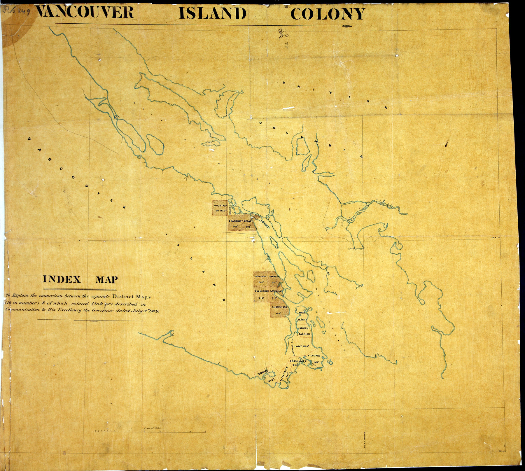
Index map: to explain the connection between the separate District Maps…
1 item extracted from CO 305/10. Vancouver Island. Index map to MPG 1/241-MPG 1/248.
Scale: 1 inch to 6 miles. [Vancouver Island, 1859].
to explain the connection between the separate District Maps (16 in number), 8 of which, coloured pink, are described in the communication to His Exellency the Governor dated July 22nd, 1859.Original map produced by the Topographical Depot of the War Office, London, 1859.
Index map : to explain the connection between the separate District Maps…, 1859, National Archives of the UK, MPG 1/249. The Colonial Despatches of Vancouver Island and British Columbia 1846-1871, Edition 2.6, ed. James Hendrickson and the Colonial Despatches project. Victoria,
B.C.: University of Victoria. https://bcgenesis.uvic.ca/mpg_1-249_vi_colony_overview_indx_to_other_maps_1859.html.
Title: Index map : to explain the connection between the separate District Maps…
Subject: Vancouver Island (B.C.) -- Maps -- Indexes.
Subject: Vancouver Island, 1859
Identifier (repository): MPG
Identifier (repoNumber): 1
Identifier (repoVol): 249
Identifier (libFileName): MPG1-249
Identifier (penfoldNum): 569
Identifier (doc_id): MPG 1/249
Date: 1859
Funder: Funded by a Canadian Council of Archives, Archival Community Digitization Program.
Publisher: National Archives of the UK.