Colonial Despatches
The colonial despatches of Vancouver Island and British Columbia 1846-1871
Map of parts of British Columbia, Alberta and the States of Washington, Idaho and Montana.
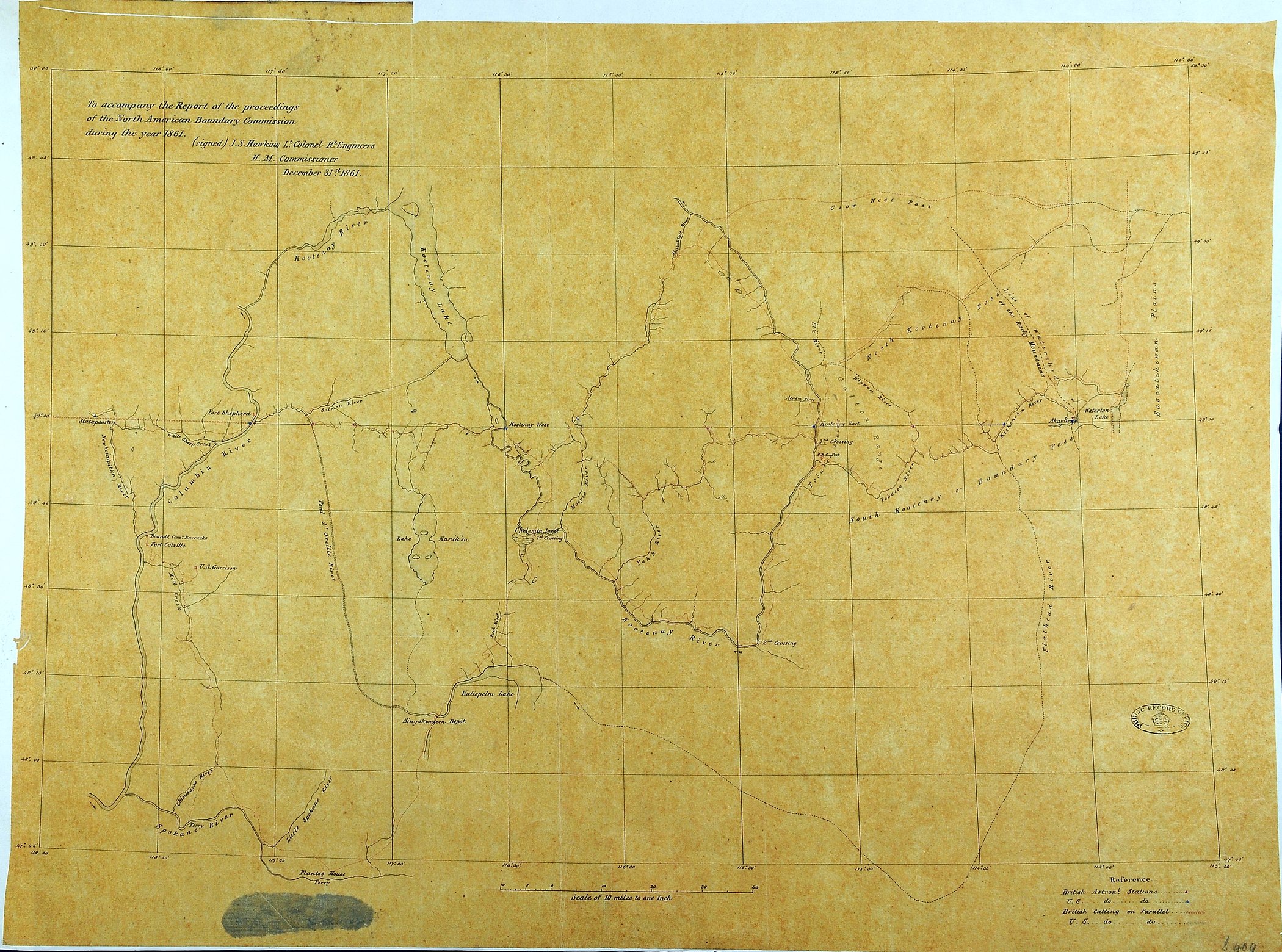
1 item (enclosure to the Report of the proceedings of the North American Boundary
Commission during the year 1861) extracted from CO 6/34. North America. Map of parts
of British Columbia, Alberta and the States of Washington, Idaho and Montana, showing
place-names, rivers, lakes, settlements, passes, crossings and ferries. Reference
table to British and United States astronomical stations. Scale: 1 inch to 10 miles.
Signed by J S Hawkins Lt Col RE, the British Commissioner, December 31st. 1861.
Hawkins, J. S. (John Summerfield), 1812-1895, Map of parts of British Columbia, Alberta and the States of Washington, Idaho and
Montana, 1861, National Archives of the UK, MPG 1/409. The Colonial Despatches of Vancouver Island and British Columbia 1846-1871, Edition 2.6, ed. James Hendrickson and the Colonial Despatches project. Victoria,
B.C.: University of Victoria. https://bcgenesis.uvic.ca/mpg_1-409_interior_bc_boundary_commission_1861.html.
Title: Map of parts of British Columbia, Alberta and the States of Washington, Idaho and Montana.
Author: Hawkins, J. S. (John Summerfield), 1812-1895
Subject: North American Boundary Commission; British Columbia -- Maps; Alberta -- maps; Washington (State) -- Maps; Idaho -- Maps; Montana -- Maps.
Identifier (repository): MPG
Identifier (repoNumber): 1
Identifier (repoVol): 409
Identifier (libFileName): MPG1-409
Identifier (penfoldNum):
Identifier (doc_id): MPG 1/409
Date: 1861
Funder: Funded by a Canadian Council of Archives, Archival Community Digitization Program.
Publisher: National Archives of the UK.
50 30'N-47 43'N/118 30'W-113 30'W