Colonial Despatches
The colonial despatches of Vancouver Island and British Columbia 1846-1871
British Columbia, showing carriage roads completed, in progress, and proposed.
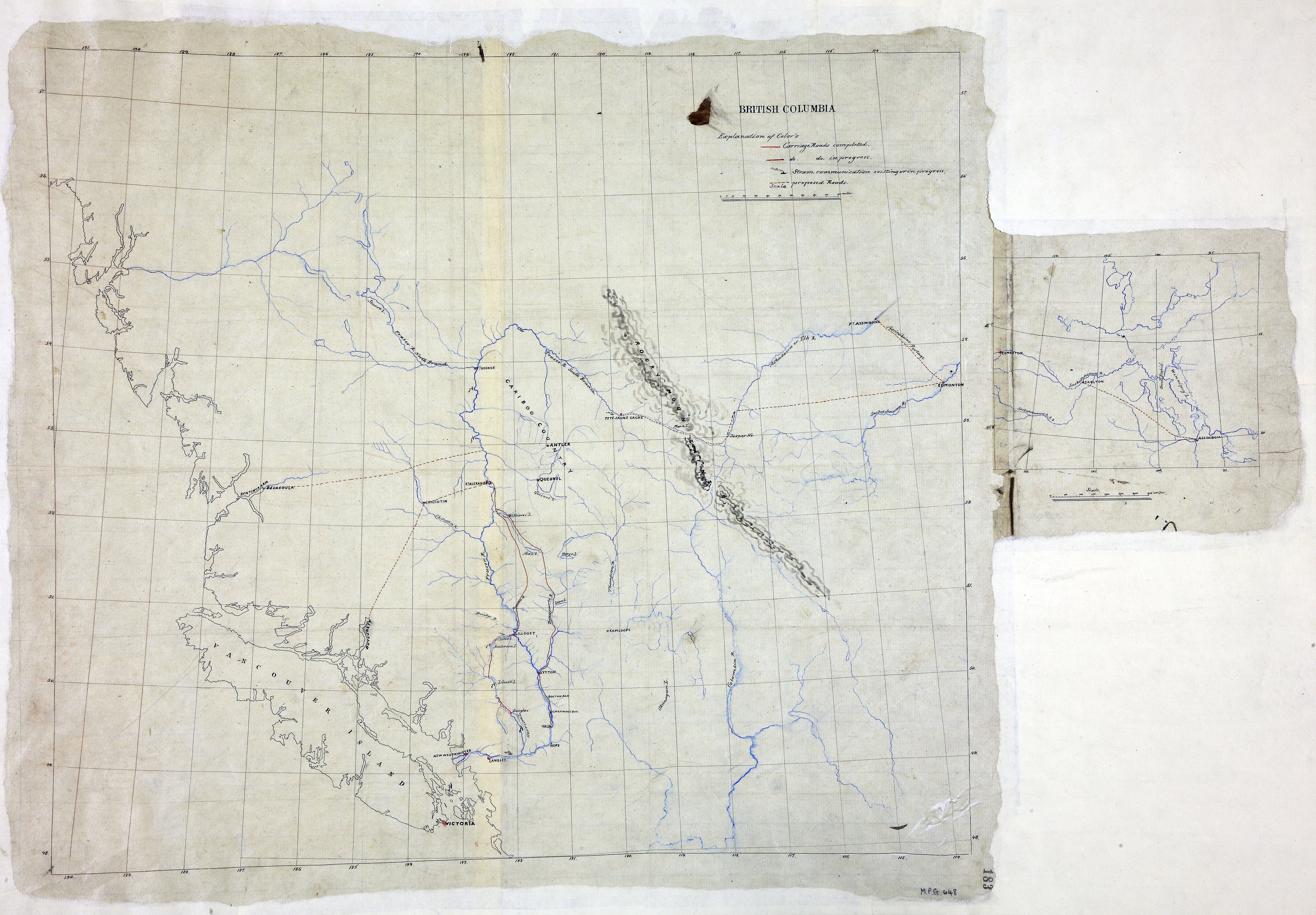
British Columbia. Map showing carriage roads completed, in progress and proposed,
and rivers accessible by steam-vessel; with an extension of the map showing proposed
roads between the Rocky Mountains and Lake Winnipeg. Reference table to roads. Scale:
1 inch to about 38 miles (main map); 1 inch to about 165 miles (extension). The extension
is at the right-hand edge and measures about 19 cm x 18. [British Columbia, 1862]
British Columbia, showing carriage roads completed, in progress, and proposed, 1862, National Archives of the UK, MPG1-648 (1). The Colonial Despatches of Vancouver Island and British Columbia 1846-1871, Edition 2.6, ed. James Hendrickson and the Colonial Despatches project. Victoria,
B.C.: University of Victoria. https://bcgenesis.uvic.ca/mpg_1-648_1_bc_1862.html.
Title: British Columbia, showing carriage roads completed, in progress, and proposed.
Subject: British Columbia -- Maps; Roads -- British Columbia -- Maps.
Subject: British Columbia, 1862
Identifier (repository): MPG
Identifier (repoNumber): 1
Identifier (repoVol): 648
Identifier (libFileName): MPG1-648 (1)
Identifier (penfoldNum): 403
Identifier (doc_id): MPG1-648 (1)
Date: 1862
Funder: Funded by a Canadian Council of Archives, Archival Community Digitization Program.
Publisher: National Archives of the UK.
57N-48N/151W-114W