Colonial Despatches
The colonial despatches of Vancouver Island and British Columbia 1846-1871
Alaska : copy of part of Vancouver's chart of the coast of southern Alaska.
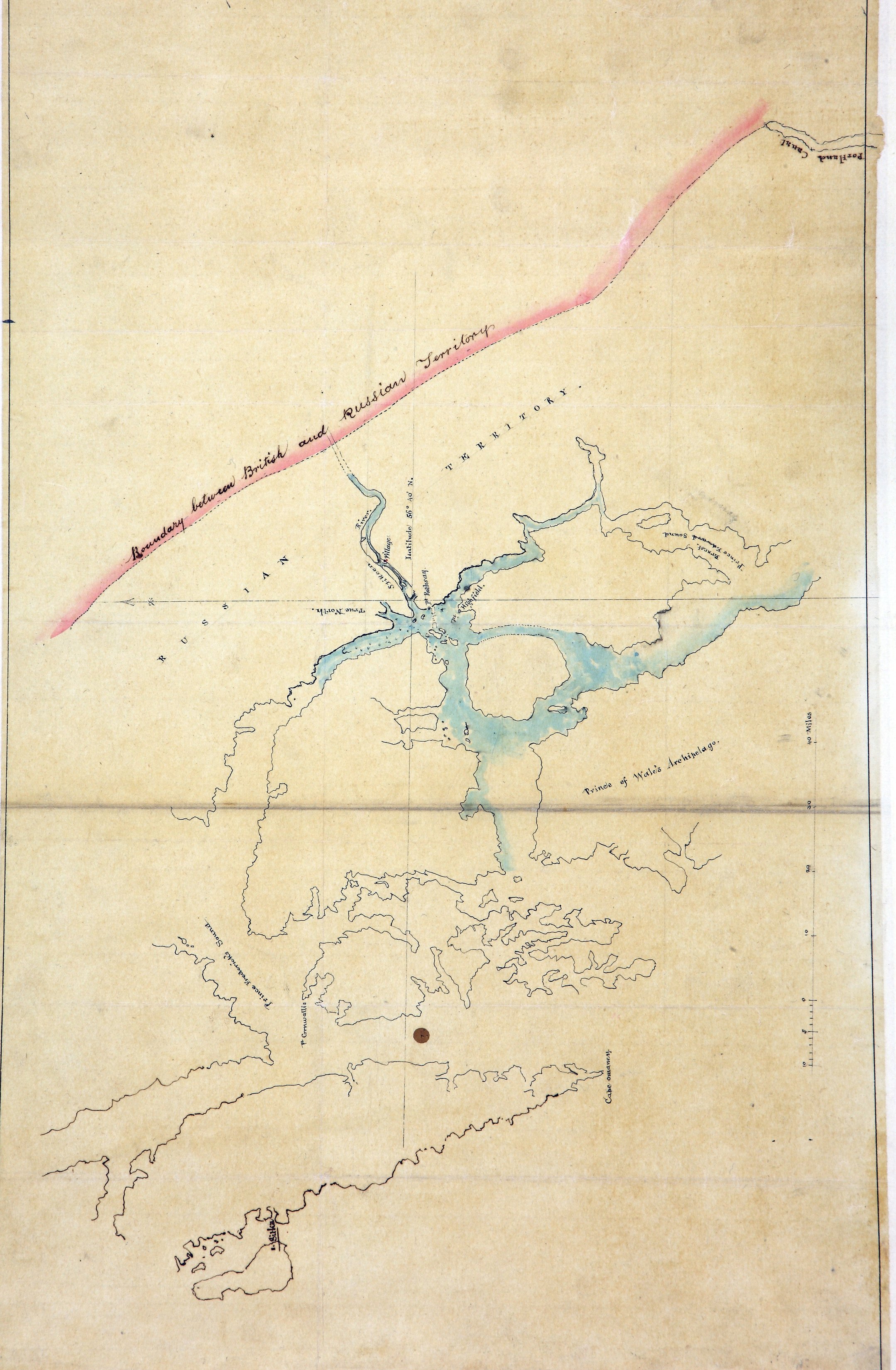
Alaska. Copy of part of Vancouver's chart of the coast of southern Alaska, roughly
east of Baranof and Prince of Wales Islands, with the mouth of the Stikine River at
its centre, showing the boundary between British and Russian territory. Scale: 1 inch
to about 11.5 miles. Compass indicator. Title supplied by cataloguer.
Vancouver, George, 1757-1798, Alaska : copy of part of Vancouver's chart of the coast of southern Alaska, 1862, National Archives of the UK, MPG1-648 (3). The Colonial Despatches of Vancouver Island and British Columbia 1846-1871, Edition 2.6, ed. James Hendrickson and the Colonial Despatches project. Victoria,
B.C.: University of Victoria. https://bcgenesis.uvic.ca/mpg_1-648_3_n_boundary_between_bc_and_russian_territory_1862.html.
Title: Alaska : copy of part of Vancouver's chart of the coast of southern Alaska.
Author: Vancouver, George, 1757-1798
Subject: Alaska--Boundaries--British Columbia--Maps; British Columbia--Boundaries--Alaska--Maps; Stikine River (B.C. and Alaska) -- Maps.
Identifier (repository): MPG
Identifier (repoNumber): 1
Identifier (repoVol): 648
Identifier (libFileName): MPG1-648 (3)
Identifier (penfoldNum):
Identifier (doc_id): MPG1-648 (3)
Date: 1862
Funder: Funded by a Canadian Council of Archives, Archival Community Digitization Program.
Publisher: National Archives of the UK.