Colonial Despatches
The colonial despatches of Vancouver Island and British Columbia 1846-1871
Plan of Williams Creek, Caribou.
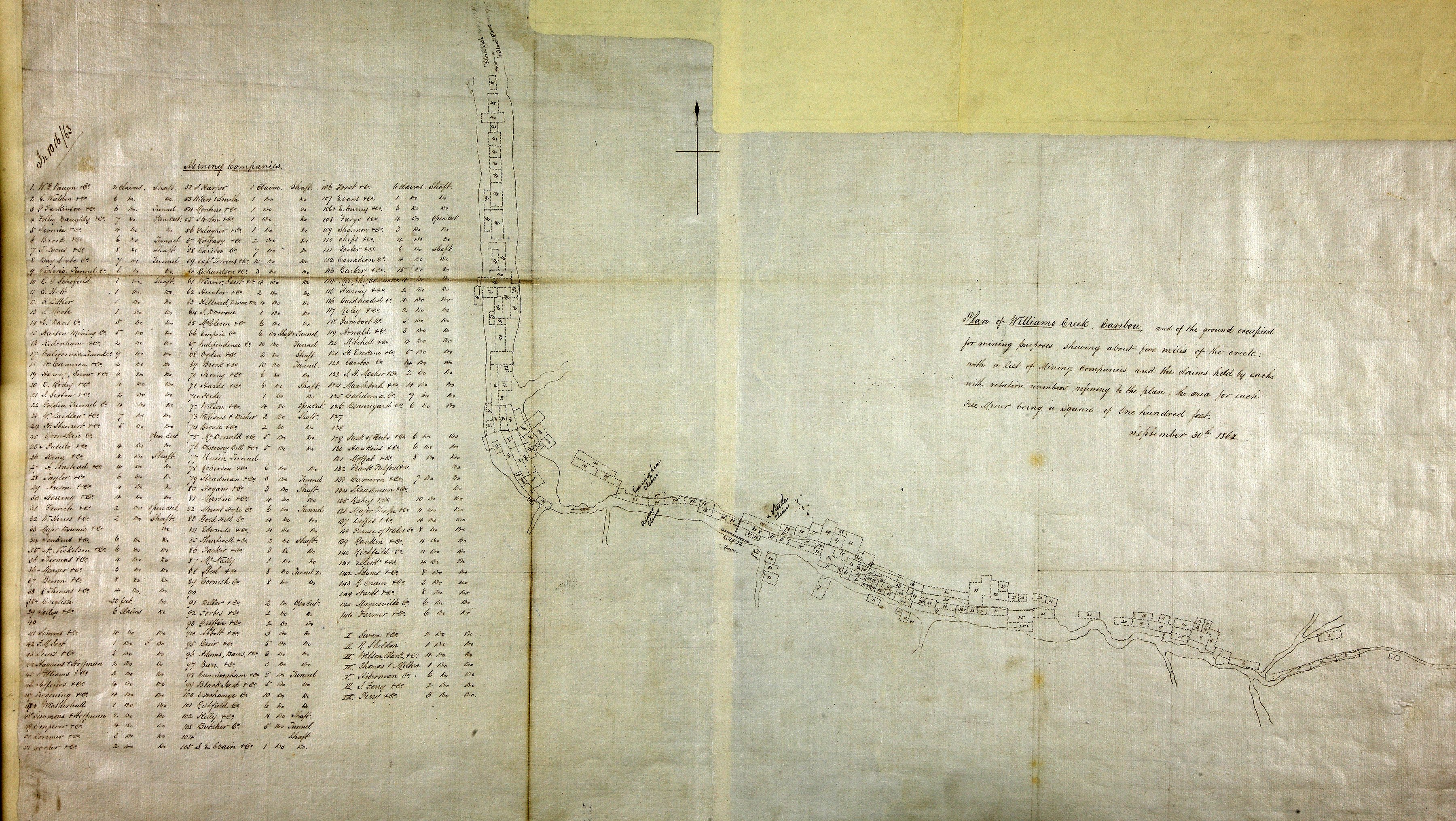
Title: Plan of Williams Creek, Caribou.
Title: Williams Creek
Subject: Williams Creek (B.C.) -- Maps; Gold mines and mining -- British Columbia -- Williams Creek; Gold mines and mining -- Cariboo Region (B.C.); Cariboo Region (B.C.) -- Gold discoveries; Mining claims -- British Columbia; Mining corporations -- British Columbia.
Subject: Williams Creek, 1862
Identifier (repository): MPG
Identifier (repoNumber): 1
Identifier (repoVol): 648
Identifier (libFileName): MPG1-648 (4)
Identifier (penfoldNum): 592
Identifier (doc_id): MPG1-648 (4)
Date: 1862
Funder: Funded by a Canadian Council of Archives, Archival Community Digitization Program.
Publisher: National Archives of the UK.