Colonial Despatches
The colonial despatches of Vancouver Island and British Columbia 1846-1871
Bute Inlet and Fraser River routes from the mouth of the Quesnel River to Victoria on Vancouver Island.
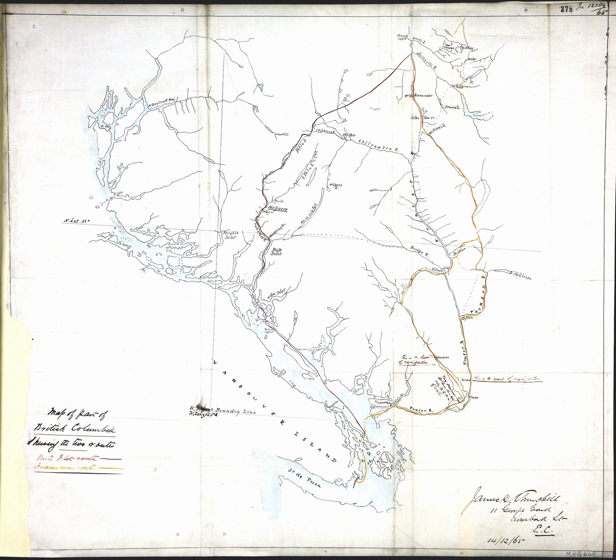
1 item extracted from CO 60/23 (folio 278). Map of part of British Columbia, showing
the Bute Inlet and Fraser River routes from the mouth of the Quesnel River to Victoria
on Vancouver Island, showing place names, rivers, and notes on navigation. Signed
by James D Churchill, 11 George Yard, Lombard St, EC, 14 December 1865. [British Columbia,
1865]. Relating to Alfred Waddington's request for a charter to construct a road
to the Cariboo gold fields.
Churchill, James D., Bute Inlet and Fraser River routes from the mouth of the Quesnel River to Victoria
on Vancouver Island, 1865, National Archives of the UK, MPG1-649. The Colonial Despatches of Vancouver Island and British Columbia 1846-1871, Edition 2.6, ed. James Hendrickson and the Colonial Despatches project. Victoria,
B.C.: University of Victoria. https://bcgenesis.uvic.ca/mpg_1-649_bc_1865.html.
Title: Bute Inlet and Fraser River routes from the mouth of the Quesnel River to Victoria on Vancouver Island.
Title: British Columbia showing the Bute Inlet and Fraser River routes.
Author: Churchill, James D.
Subject: British Columbia -- Maps; Bute Inlet (B.C.) -- Maps; Fraser River (B.C.) -- Maps; Roads -- British Columbia.
Subject: British Columbia, 1865
Identifier (repository): MPG
Identifier (repoNumber): 1
Identifier (repoVol): 649
Identifier (libFileName): MPG1-649
Identifier (penfoldNum): 418
Identifier (doc_id): MPG1-649
Date: 1865
Funder: Funded by a Canadian Council of Archives, Archival Community Digitization Program.
Publisher: National Archives of the UK.