Colonial Despatches
The colonial despatches of Vancouver Island and British Columbia 1846-1871
Skeleton map of part of British Columbia.
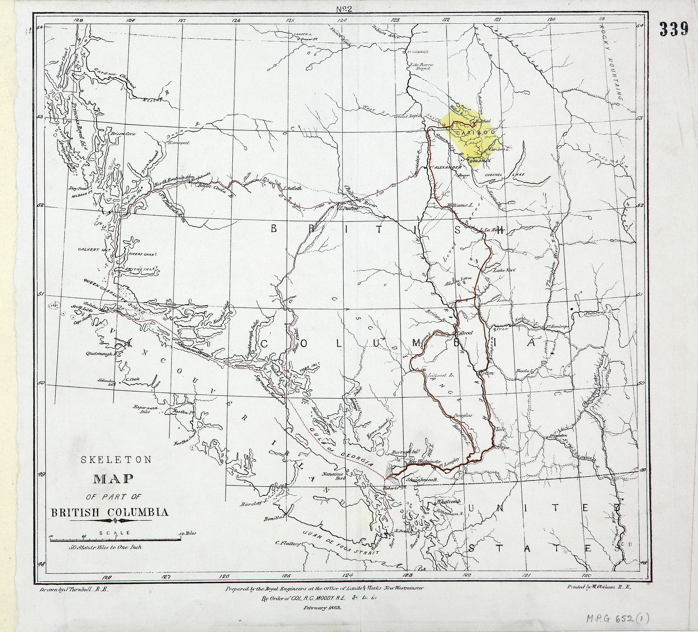
Skeleton Map of part of British Columbia'. Scale: 1 inch to 50 miles. Drawn by J Turnbull,
RE. Printed by W Oldham, RE. Prepared by the Royal Engineers at the Office of Lands
& Works, New Westminster. By order of R C Moody, Col RE, February 1863. [British Columbia,
1863]. Cariboo gold area shown in yellow.
Turnbull, James, Skeleton map of part of British Columbia, 1863, British Columbia. Dept. of Lands and Works, MPG1-652 (1). The Colonial Despatches of Vancouver Island and British Columbia 1846-1871, Edition 2.6, ed. James Hendrickson and the Colonial Despatches project. Victoria,
B.C.: University of Victoria. https://bcgenesis.uvic.ca/mpg_1-652_1_bc_1863.html.
Title: Skeleton map of part of British Columbia.
Author: Turnbull, James
Subject: British Columbia -- Maps
Subject: British Columbia, 1863
Identifier (repository): MPG
Identifier (repoNumber): 1
Identifier (repoVol): 652
Identifier (libFileName): MPG1-652 (1)
Identifier (penfoldNum): 412
Identifier (doc_id): MPG1-652 (1)
Date: 1863
Funder: Funded by a Canadian Council of Archives, Archival Community Digitization Program.
Publisher: British Columbia. Dept. of Lands and Works.
Publisher: National Archives of the UK.
54N-48N/129W-119W