Colonial Despatches
The colonial despatches of Vancouver Island and British Columbia 1846-1871
Rough Sketch of Part of British Columbia traced from Lieut. Palmer's plan of Cariboo District.
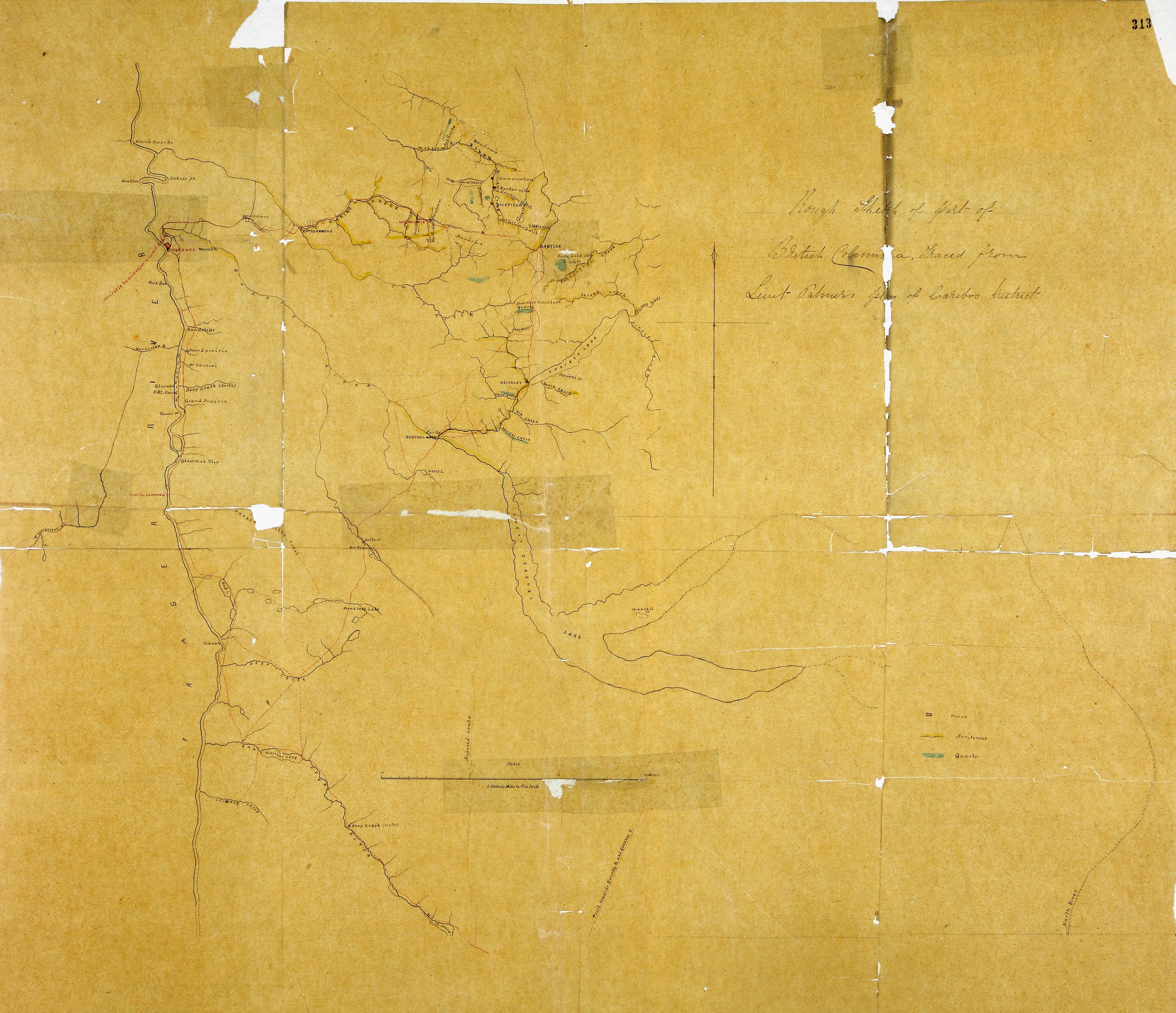
1 item extracted from CO 60/16 (folio 313). 'Rough Sketch of Part of British Columbia
traced from Lieut. Palmer's plan of Cariboo [now Caribou] District.' The map shows
the area east of the Fraser River and north of Lake Quesnel with place names, rivers,
lakes, trails, mineral deposits. Reference table to quartz and gold-bearing deposits.
Scale: 1 inch to 5 miles. Compass indicator. [British Columbia, c. 1863]
Palmer, H. Spencer (Henry Spencer), 1838-1893, Rough Sketch of Part of British Columbia traced from Lieut. Palmer's plan of Cariboo
District, 1863, National Archives of the UK, MPG1-653. The Colonial Despatches of Vancouver Island and British Columbia 1846-1871, Edition 2.6, ed. James Hendrickson and the Colonial Despatches project. Victoria,
B.C.: University of Victoria. https://bcgenesis.uvic.ca/mpg_1-653_bc_caribou_1863_nk.html.
Title: Rough Sketch of Part of British Columbia traced from Lieut. Palmer's plan of Cariboo District.
Title: Cariboo District.
Author: Palmer, H. Spencer (Henry Spencer), 1838-1893
Subject: Cariboo Region (B.C.) -- Maps; Fraser River (B.C.); Quesnel (B.C.); Gold mines and mining -- British Columbia.
Subject: British Columbia, 1863
Identifier (repository): MPG
Identifier (repoNumber): 1
Identifier (repoVol): 653
Identifier (libFileName): MPG1-653
Identifier (penfoldNum): 415
Identifier (doc_id): MPG1-653
Date: 1863
Funder: Funded by a Canadian Council of Archives, Archival Community Digitization Program.
Publisher: National Archives of the UK.