Colonial Despatches
The colonial despatches of Vancouver Island and British Columbia 1846-1871
Northern British Columbia.
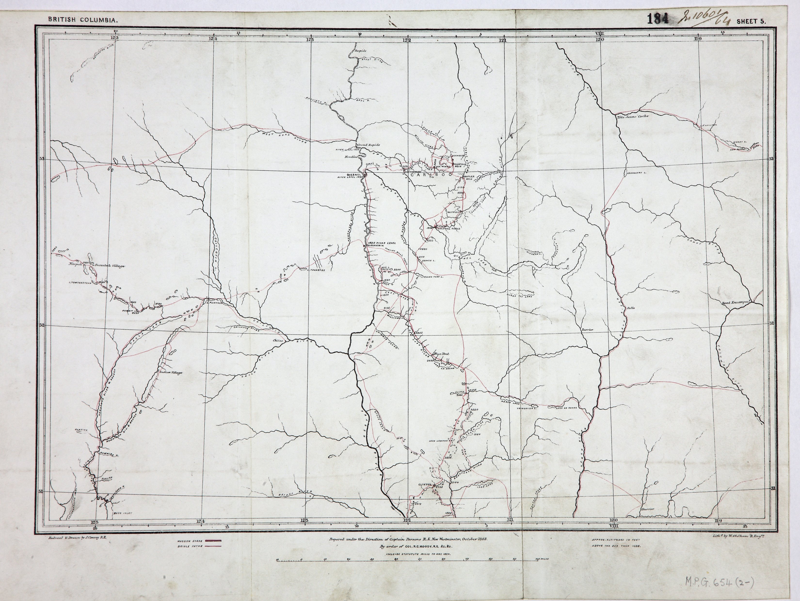
British Columbia, Sheet 5'. Map of the country between 118 30'W and 125 30'W and between
51N and 5340'N. Scale: 1 inch to 20 miles. Reduced and drawn by J Conroy, RE. Prepared
under the direction of Capt Parsons, RE, New Westminster, October 1863, by order of
R C Moody, Col RE. Lithographed by W Oldham, RE. [British Columbia, 1863]. Shows
locations of First Nations villages, wagon roads and bridle paths. Title supplied
by cataloger.
Conroy, James, Northern British Columbia, 1863, Great Britain. Army. Royal Engineers. Columbia Detachment, MPG1-654 (2). The Colonial Despatches of Vancouver Island and British Columbia 1846-1871, Edition 2.6, ed. James Hendrickson and the Colonial Despatches project. Victoria,
B.C.: University of Victoria. https://bcgenesis.uvic.ca/mpg_1-654_2_bc_interior_1863.html.
Title: Northern British Columbia.
Title: British Columbia, Sheet 5'.
Author: Conroy, James
Subject: British Columbia, Northern -- Maps; Chilcotin Plateau (B.C.) -- Maps; Cariboo Region (B.C.) -- Maps; Indians of North America -- British Columbia.
Subject: British Columbia, 1863
Identifier (repository): MPG
Identifier (repoNumber): 1
Identifier (repoVol): 654
Identifier (libFileName): MPG1-654 (2)
Identifier (penfoldNum): 411
Identifier (doc_id): MPG1-654 (2)
Date: 1863
Funder: Funded by a Canadian Council of Archives, Archival Community Digitization Program.
Publisher: Great Britain. Army. Royal Engineers. Columbia Detachment.
Publisher: National Archives of the UK.
53 40'N-50 50'N/126 20'W-118 20'W