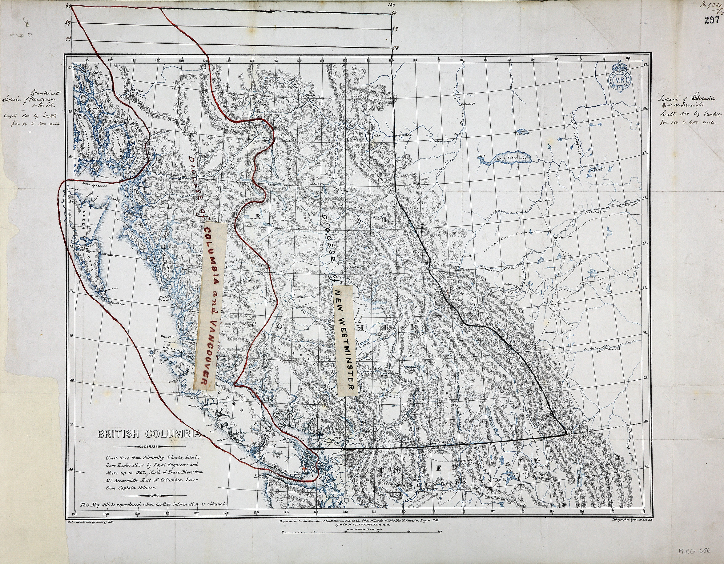
1 item extracted from CO 60/20 (folio 297). 'British Columbia. Coast lines from Admiralty
Charts, interior from Explorations by Royal Engineers and others up to 1862. North
of Fraser River from Mr. Arrowsmith. East of Columbia River from Captain Palliser…'.
Scale: 1 inch to 50 miles. Reduced and drawn by J. Conroy, RE. Prepared under the
direction of Capt Parsons, RE, at the Office of Lands & Works, New Westminster, August
1862, by order of R C Moody, Col RE. Lithographed by W. Oldham, RE. MS additions show
the dioceses of New Westminster andColumbia with Vancouver. The diocese of Columbia
with Vancouver includes the Queen Charlotte Islands and a large tract of mainland
British Columbia. Two additional marginal notes show rough dimensions of the two dioceses.
[British Columbia, 1862; c. 1864]
Conroy, James.,
British Columbia. Coast lines from Admiralty Charts, interior from Explorations by
Royal Engineers and others up to 1862. North of Fraser River from Mr. Arrowsmith.
East of Columbia River from Captain Palliser, 1862, British Columbia. Dept. of Lands and Works, MPG1-656.
The Colonial Despatches of Vancouver Island and British Columbia 1846-1871, Edition 2.6, ed. James Hendrickson and the Colonial Despatches project. Victoria,
B.C.: University of Victoria.
https://bcgenesis.uvic.ca/mpg_1-656_bc_1862.html.
Title: British Columbia. Coast lines from Admiralty Charts, interior from Explorations
by Royal Engineers and others up to 1862. North of Fraser River from Mr. Arrowsmith.
East of Columbia River from Captain Palliser.
Author: Conroy, James.
Subject: British Columbia -- Maps; Vancouver Island (B.C.) -- Maps; Dioceses.
Subject: British Columbia, 1862, 1864
Identifier (repository): MPG
Identifier (repoNumber): 1
Identifier (repoVol): 656
Identifier (libFileName): MPG1-656
Identifier (penfoldNum): 410
Identifier (doc_id): MPG1-656
Date: 1862
Funder: Funded by a Canadian Council of Archives, Archival Community Digitization
Program.
Publisher: British Columbia. Dept. of Lands and Works.
Publisher: National Archives of the UK.
View in UVic Libraries Vault repository
57N-48N/133W-110W