Colonial Despatches
The colonial despatches of Vancouver Island and British Columbia 1846-1871
Sketch map of part of British Columbia shewing trails and routes of communication.
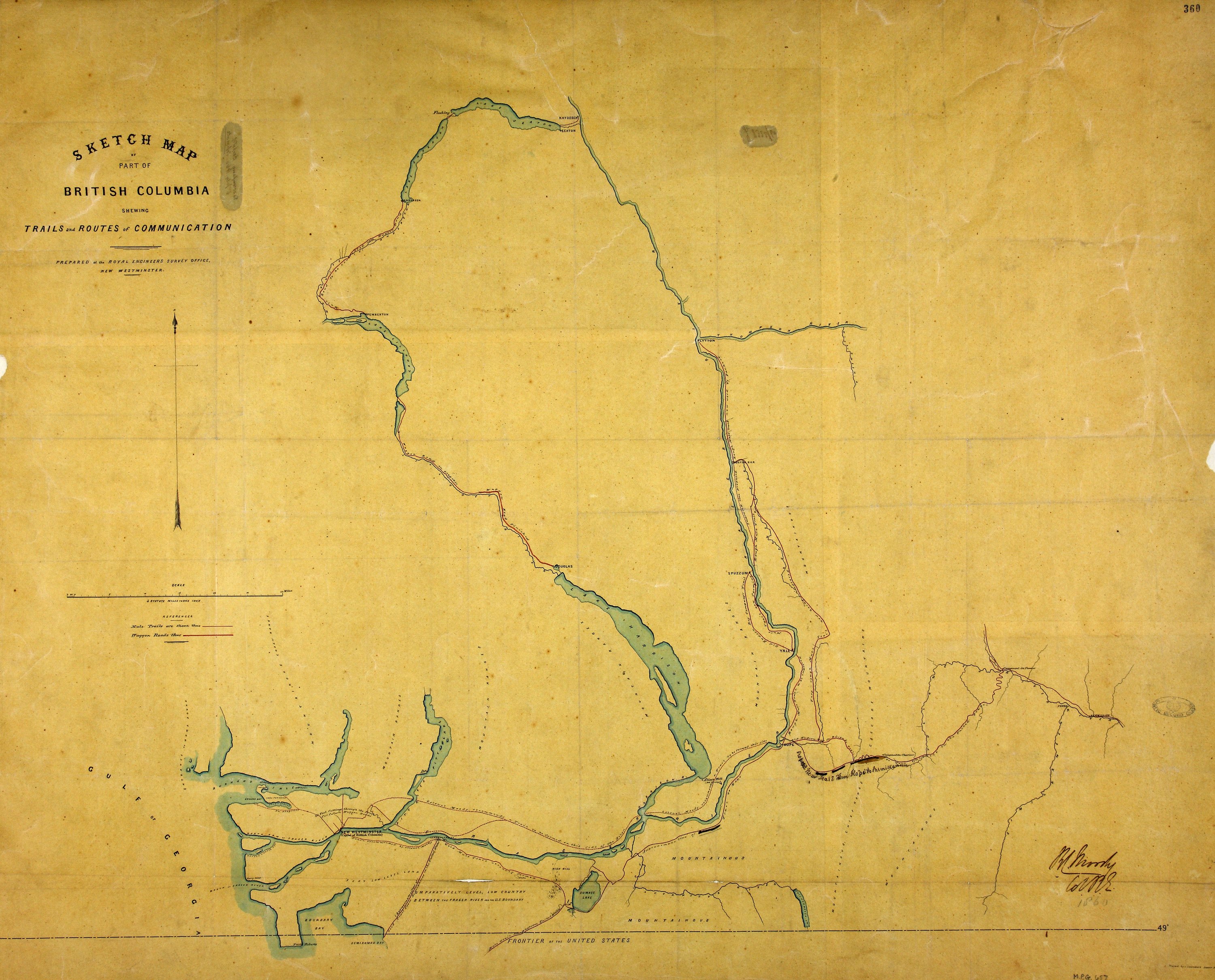
1 item extracted from CO 60/7 (folio 360). 'Sketch Map of Part of British Columbia
shewing Trails and Routes of Communication'. Map showing trails between New Westminster,
Hope, Vermilion, Lytton and Lakes Harrison, Lillooet, Anderson and Seton. Reference
table to trails. Scale: 1 inch to 5 miles. Compass indicator. Prepared at the Royal
Engineers Survey Office, New Westminster. Traced by J Launders, Sapper RE. Signed
by R C Moody, Col RE. [British Columbia, 1860]. Shows wagon roads and mule trails.
Launders, James Benjamin, d. 1878; Moody, R. C. (Richard Clement), 1813-1887, Sketch map of part of British Columbia shewing trails and routes of communication, 1860, Great Britain. Army. Royal Engineers. Columbia Detachment, MPG 1/657. The Colonial Despatches of Vancouver Island and British Columbia 1846-1871, Edition 2.6, ed. James Hendrickson and the Colonial Despatches project. Victoria,
B.C.: University of Victoria. https://bcgenesis.uvic.ca/mpg_1-657_bc_south_mainland_1860.html.
Title: Sketch map of part of British Columbia shewing trails and routes of communication.
Author: Launders, James Benjamin, d. 1878; Moody, R. C. (Richard Clement), 1813-1887
Subject: British Columbia, Southern -- Maps; Roads -- British Columbia, Southern -- Maps
Subject: British Columbia, 1860
Identifier (repository): MPG
Identifier (repoNumber): 1
Identifier (repoVol): 657
Identifier (libFileName): MPG1-657
Identifier (penfoldNum): 390
Identifier (doc_id): MPG 1/657
Date: 1860
Funder: Funded by a Canadian Council of Archives, Archival Community Digitization Program.
Publisher: Great Britain. Army. Royal Engineers. Columbia Detachment.
Publisher: National Archives of the UK.