Colonial Despatches
The colonial despatches of Vancouver Island and British Columbia 1846-1871
Map of the subdivisions of Beckley Farm and the Lands South and West of James Bay, Victoria, Vancouver Island. 7th. January 1863.
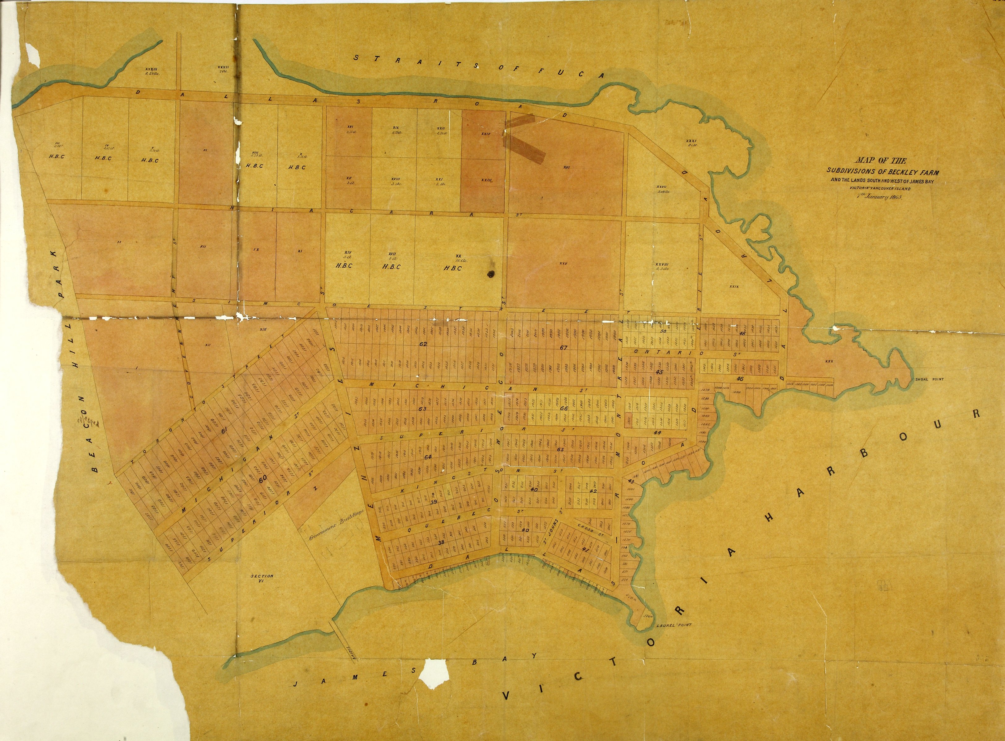
1 item extracted from CO 305/21 (folio 212). British Columbia. 'Map of the subdivisions
of Beckley Farm and the Lands South and West of James Bay, Victoria, Vancouver Island.
7th. January 1863' with named streets, numbered lots, proprietors, and acreage. [Victoria,
1863]. James Bay Peninsula, formerly a HBC farm.
Map of the subdivisions of Beckley Farm and the Lands South and West of James Bay,
Victoria, Vancouver Island. 7th. January 1863, 1863, National Archives of the UK, MPG1-659. The Colonial Despatches of Vancouver Island and British Columbia 1846-1871, Edition 2.6, ed. James Hendrickson and the Colonial Despatches project. Victoria,
B.C.: University of Victoria. https://bcgenesis.uvic.ca/mpg_1-659_vic_james_bay_1863.html.
Title: Map of the subdivisions of Beckley Farm and the Lands South and West of James Bay, Victoria, Vancouver Island. 7th. January 1863.
Title: Beckley Farm
Subject: Victoria (B.C.) -- Maps; James Bay (Victoria, B.C.) -- Maps; Vancouver Island (B.C.) -- Victoria -- Maps; City planning -- British Columbia -- Victoria.
Subject: Victoria, 1863
Identifier (repository): MPG
Identifier (repoNumber): 1
Identifier (repoVol): 659
Identifier (libFileName): MPG1-659
Identifier (penfoldNum): 582
Identifier (doc_id): MPG1-659
Date: 1863
Funder: Funded by a Canadian Council of Archives, Archival Community Digitization Program.
Publisher: National Archives of the UK.