Sketch of Cammusan Harbour south end of Vancouver's Island, Straits of De Fuca shewing position of Fort Victoria & soundings.

Sketch of Cammusan Harbour south end of Vancouver's Island, Straits of De Fuca shewing position of Fort Victoria & soundings.
Vancouver Island (now in British Columbia). 'Sketch of Cammusan Harbour South End of Vancouver's Island…': map showing the position of Fort Victoria, soundings and place names. Reference notes on tides and soundings. Scale: 1 inch to 100 fathoms. Compass indicator. By Lieutenant M Vavasour, Royal Engineers; from a drawing by J Scarboro of the Hudson's Bay Company. [Vancouver Island, c. 1845]
Vavasour, M (Mervin), 1821-1866, Sketch of Cammusan Harbour south end of Vancouver's Island, Straits of De Fuca shewing position of Fort Victoria & soundings, 1845, National Archives of the UK, MPHH 1/459/3. The Colonial Despatches of Vancouver Island and British Columbia 1846-1871, Edition 2.4, ed. James Hendrickson and the Colonial Despatches project. Victoria, B.C.: University of Victoria. https://bcgenesis.uvic.ca/mphh_1-459_pt_1_3_camussan_harbour_vic_harbour_1845.html.

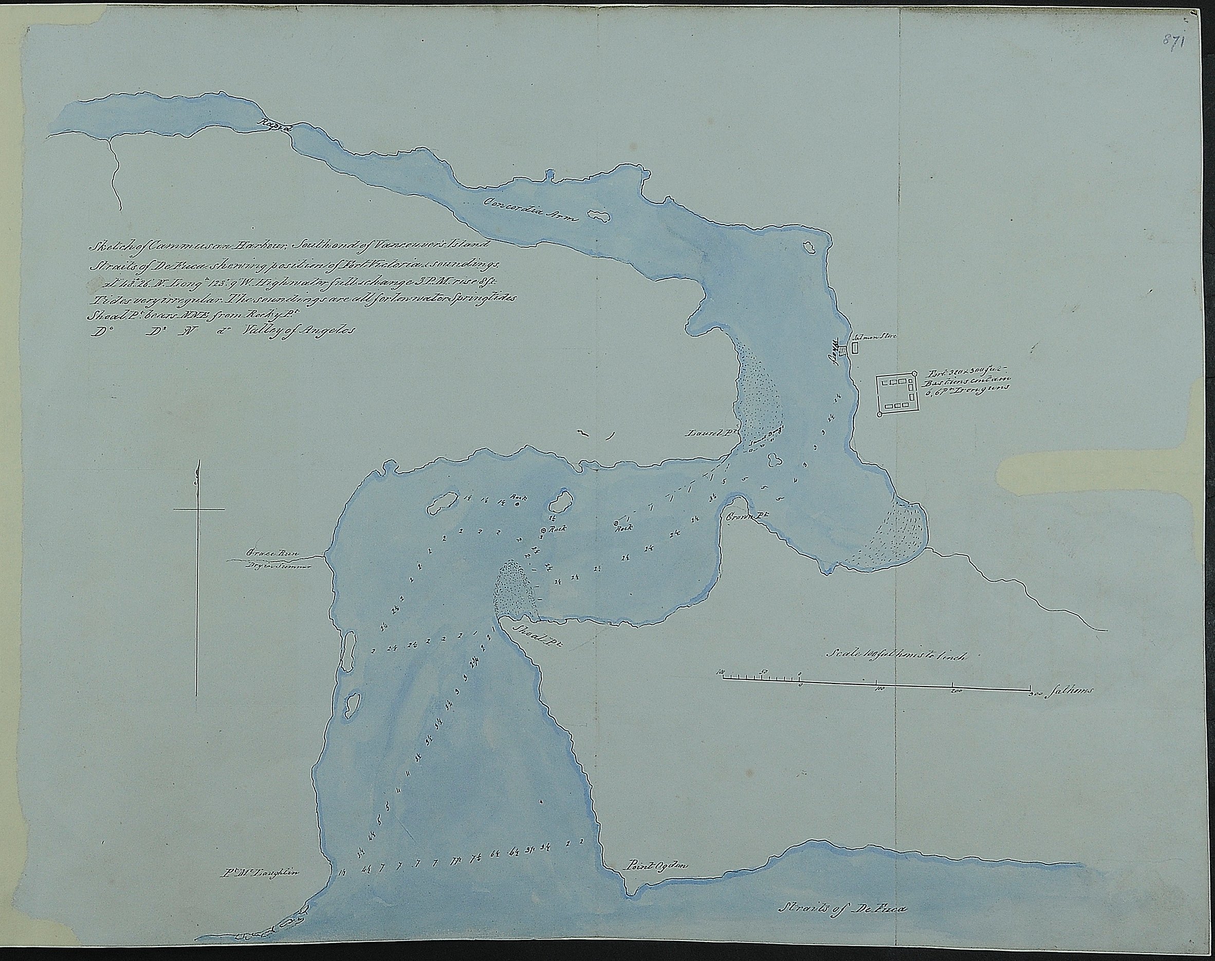
Title: Sketch of Cammusan Harbour south end of Vancouver's Island, Straits of De Fuca shewing position of Fort Victoria & soundings.

Title: Cammusan Harbour (Victoria Harbour), British Columbia.

Author: Vavasour, M (Mervin), 1821-1866

Subject: Victoria Harbour (B.C.) -- Maps; Nautical charts -- British Columbia -- Victoria; Harbors - British Columbia -- Victoria.

Subject: Vancouver Island, 1845

Identifier (repository): MPHH

Identifier (repoNumber): 1

Identifier (repoVol): 459

Identifier (libFileName): MPHH1-459 (3)

Identifier (penfoldNum): 555

Identifier (doc_id): MPHH 1/459/3

Date: 1845

Funder: Funded by a Canadian Council of Archives, Archival Community Digitization Program.

Publisher: National Archives of the UK.

Identifier (CONTENTdm): oai:contentdm.library.uvic.ca:collection5/264