Colonial Despatches
The colonial despatches of Vancouver Island and British Columbia 1846-1871
Sketch shewing the route (in red) from Red River to the Pacific Ocean.
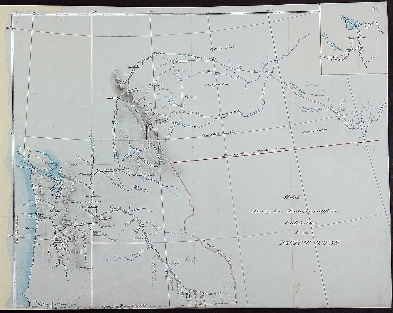
Canada (west of Manitoba), United States of America (west of Minnesota). 'Sketch shewing
the Route (in red) from Red River to the Pacific Ocean': map showing forts, place-names,
rivers and the route of American emigrants along the Snake River from Idaho and Oregon.
Approximate scale: 1 inch to 83 miles [1:5,258,880]. Inset: eastern section of route.
The map shows Lieutenants Warre and Vavasour's route from Fort Garry Upper, Red River,
south of Lake Winnipeg to the mouth of the Columbia River (Washington State) and then
northwards to Victoria, Vancouver Island, 1845.
Vavasour, M. (Mervin), 1821-1866, Sketch shewing the route (in red) from Red River to the Pacific Ocean, 1845, National Archives of the UK, MPHH 1/459/8 . The Colonial Despatches of Vancouver Island and British Columbia 1846-1871, Edition 2.6, ed. James Hendrickson and the Colonial Despatches project. Victoria,
B.C.: University of Victoria. https://bcgenesis.uvic.ca/mphh_1-459_pt_1_8_routes_from_red_river_to_bc_1845.html.
Title: Sketch shewing the route (in red) from Red River to the Pacific Ocean.
Author: Vavasour, M. (Mervin), 1821-1866
Subject: Canada, Western -- Maps; British Columbia -- Maps; West (U.S.) -- Maps.
Identifier (repository): MPHH
Identifier (repoNumber): 1
Identifier (repoVol): 459
Identifier (libFileName): MPHH1-459 (8)
Identifier (penfoldNum):
Identifier (doc_id): MPHH 1/459/8
Date: 1845
Funder: Funded by a Canadian Council of Archives, Archival Community Digitization Program.
Publisher: National Archives of the UK.