Colonial Despatches
The colonial despatches of Vancouver Island and British Columbia 1846-1871
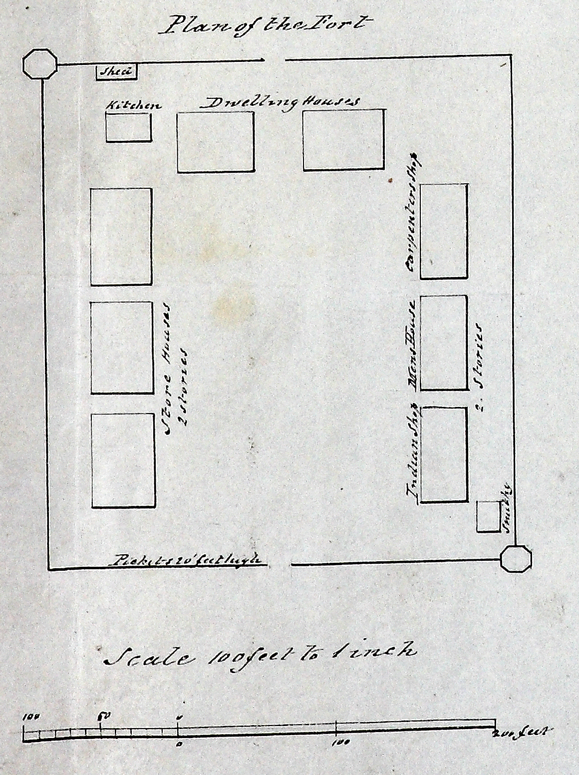
Sketch of Cammusan Harbour, Vancouvers Island, showing the position of Fort Victoria.
Title: Sketch of Cammusan Harbour, Vancouvers Island, showing the position of Fort Victoria.
Title: Cammusan Harbour (Victoria Harbour), British Columbia.
Author: Vavasour, M (Mervin), 1821-1866
Subject: Victoria Harbour (B.C.) -- Maps; Nautical charts -- British Columbia -- Victoria; Harbors - British Columbia -- Victoria; Victoria (B.C.) -- History..
Subject: Vancouver Island, 1846
Identifier (repository): MPK
Identifier (repoNumber): 1
Identifier (repoVol): 59
Identifier (libFileName): MPK1-59 (10)
Identifier (penfoldNum): 556
Identifier (doc_id): MPK 1/59/10
Date: 1846
Funder: Funded by a Canadian Council of Archives, Archival Community Digitization Program.
Publisher: National Archives of the UK.
48.450407 -123.413000 48.411488 -123.413000 48.411488 -123.365744 48.450407 -123.365744