Colonial Despatches
The colonial despatches of Vancouver Island and British Columbia 1846-1871
Eye Sketch of the Plains &c about Nisqually at the Head of Pugets Sound.
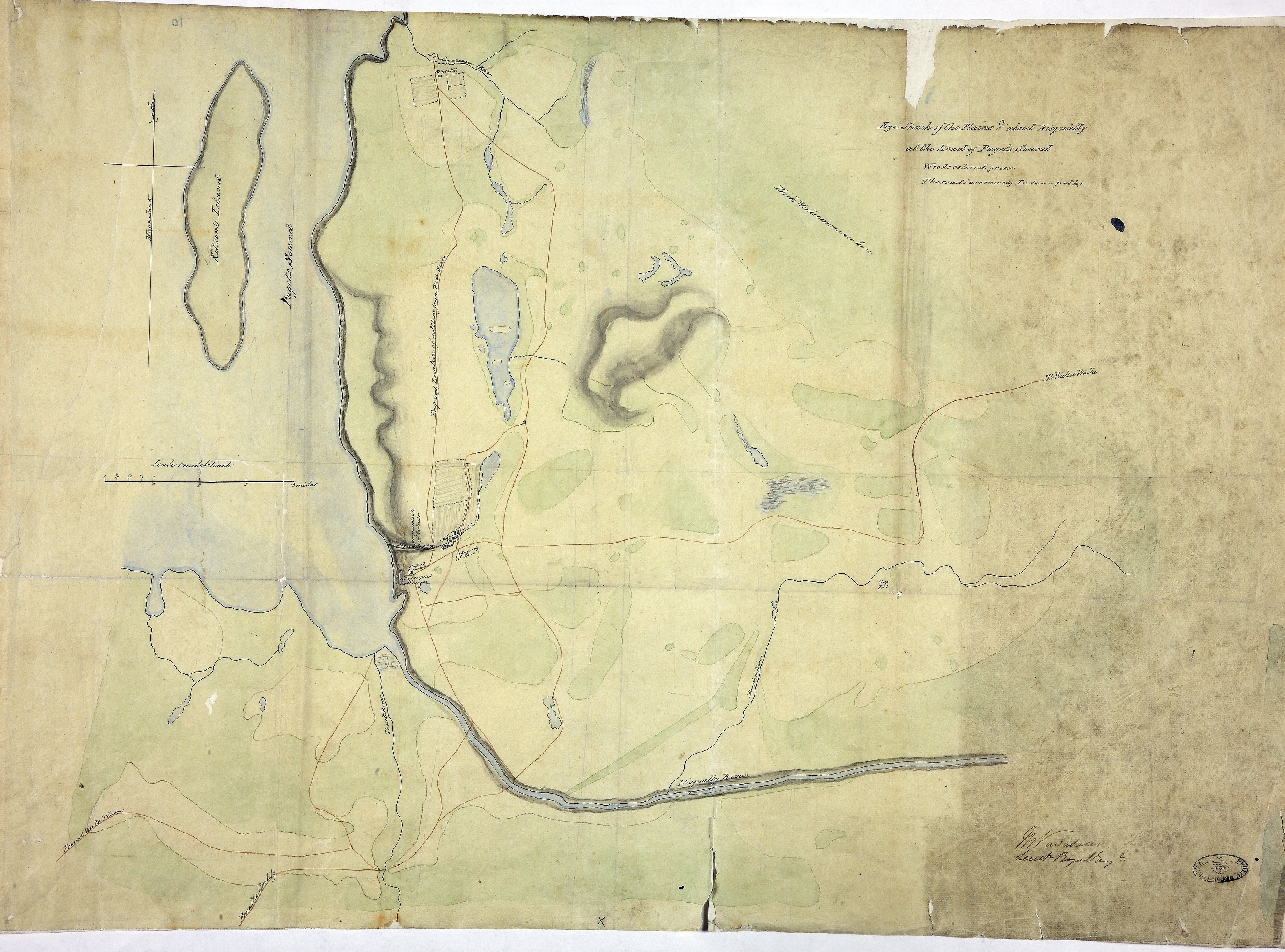
Eye Sketch of the Plains &c about Nisqually at the Head of Pugets Sound' (now in Washington
state): shows place names, rivers, old fort, woods, proposed location of settlers,
Indian paths. Scale: 1 inch to 1 mile. Compass indicator. Drawn by M Vavasour, Lt
RE.
Vavasour, M (Mervin), 1821-1866, Eye Sketch of the Plains &c about Nisqually at the Head of Pugets Sound, 1846, National Archives of the UK, MPK 1/59/11. The Colonial Despatches of Vancouver Island and British Columbia 1846-1871, Edition 2.6, ed. James Hendrickson and the Colonial Despatches project. Victoria,
B.C.: University of Victoria. https://bcgenesis.uvic.ca/mpk_1-59_11_skeena_1846nk.html.
Title: Eye Sketch of the Plains &c about Nisqually at the Head of Pugets Sound.
Title: Sketch of Nisqually and adjacent Plains on Puget's Sound.
Author: Vavasour, M (Mervin), 1821-1866
Subject: Nisqually River Valley (Wash.) -- Maps; Nisqually River (Wash.) -- Maps; Fort Nisqually (Wash.) -- Maps; Puget Sound (Wash.) -- Maps
Identifier (repository): MPK
Identifier (repoNumber): 1
Identifier (repoVol): 59
Identifier (libFileName): MPK1-59 (11)
Identifier (penfoldNum):
Identifier (doc_id): MPK 1/59/11
Date: 1846
Funder: Funded by a Canadian Council of Archives, Archival Community Digitization Program.
Publisher: National Archives of the UK.