Colonial Despatches
The colonial despatches of Vancouver Island and British Columbia 1846-1871
Chart of the west coast of North America either side of the forty-ninth parallel.
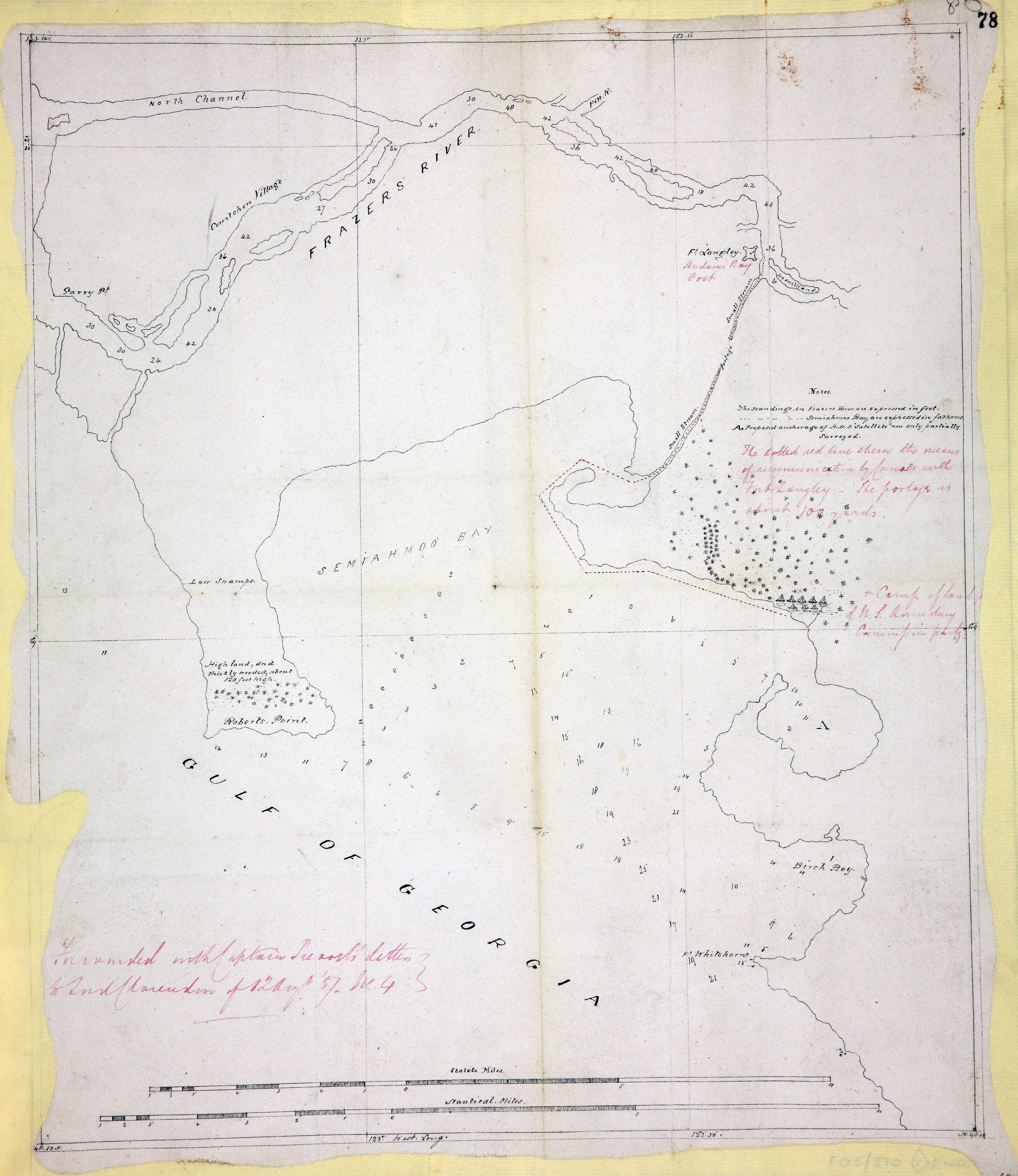
Chart of the west coast of North America either side of the forty-ninth parallel:
shows soundings in the Strait of Georgia and the Fraser River; canoe route up the
Fraser River; camp of the United States boundary surveying party; proposed anchorage
for HMS Satellite to survey the area south of 49N. Topographical notes. Notes on the
survey. Scale: 1 inch to about 1.5 miles. Drawn by J. Roberts, draughtsman. Extracted
from Capt J C Prevost's despatch no 4 of 12 August 1857 to Lord Clarendon. [Georgia,
Strait, 1857]
Roberts, J., Chart of the west coast of North America either side of the forty-ninth parallel, 1857-1858, National Archives of the UK, MPK 1/66/1. The Colonial Despatches of Vancouver Island and British Columbia 1846-1871, Edition 2.6, ed. James Hendrickson and the Colonial Despatches project. Victoria,
B.C.: University of Victoria. https://bcgenesis.uvic.ca/mpk_1-66_1_georgia_s_1857_labelled_1858.html.
Title: Chart of the west coast of North America either side of the forty-ninth parallel.
Title: West coast of North America.
Author: Roberts, J.
Subject: British Columbia -- Maps; Washington (State) -- Maps; Georgia, Strait of (B.C. and Wash.) -- Maps; Fraser River (B.C.) -- Maps; North American Boundary Commission
Subject: Georgia, Strait, 1857
Identifier (repository): MPK
Identifier (repoNumber): 1
Identifier (repoVol): 66
Identifier (libFileName): MPK1-66 (1)
Identifier (penfoldNum): 478
Identifier (doc_id): MPK 1/66/1
Date: 1857
Funder: Funded by a Canadian Council of Archives, Archival Community Digitization Program.
Publisher: National Archives of the UK.
49 20'N-48 50'N/123 10'W-122 50'W