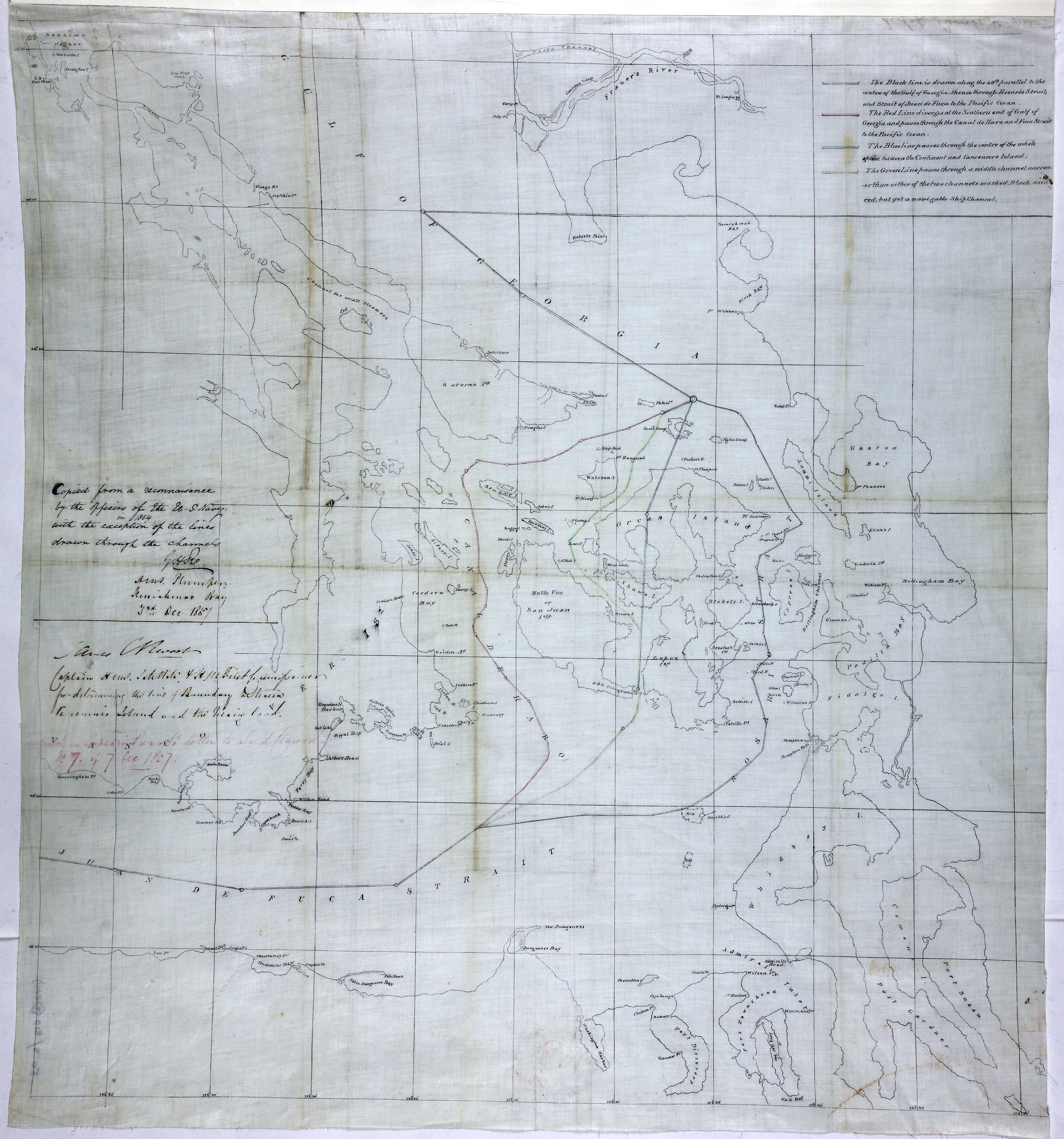
Reconnaissance of Canal de Haro & Strait of Rosario and approaches.

Reconnaissance of Canal de Haro & Strait of Rosario and approaches.
Tracing of United States Coast Survey chart: 'Reconnaissance of Canal de Haro & Strait of Rosario and approaches. Geographical Positions & Triangulation by G. Davidson Assist. Hydrography by the Party under the command of Lieut. J. Alden, U.S.N. Assist…. 1854'. Shows four suggested boundary lines between Canada and the United States of America. Key to proposed boundaries. Copied by G H Richards, Capt HMS Plumper, 3 December 1857. Extracted from Capt J C Prevost's despatch of 7 December 1857 to Lord Clarendon. [Haro and Rosario Straits, 1854; 1857]
United States Coast Survey, Reconnaissance of Canal de Haro & Strait of Rosario and approaches, 1854-1857, National Archives of the UK, MPK 1/66/2. The Colonial Despatches of Vancouver Island and British Columbia 1846-1871, Edition 2.4, ed. James Hendrickson and the Colonial Despatches project. Victoria, B.C.: University of Victoria. https://bcgenesis.uvic.ca/mpk_1-66_2_haro_and_rosario_ss_1854_1857.html.

Title: Reconnaissance of Canal de Haro & Strait of Rosario and approaches.

Title: Canal de Haro & Strait of Rosario.

Author: United States Coast Survey

Subject: Haro Strait (B.C. and Wash.) -- Maps; Rosario Strait (Wash.) -- Maps; Georgia, Strait of (B.C. and Wash.) -- Maps; Juan de Fuca Strait (B.C. and Wash.) -- Maps; Boundaries -- British Columbia; Boundaries -- United States; North American Boundary Commission.

Subject: Haro and Rosario Straits, 1854, 1857

Identifier (repository): MPK

Identifier (repoNumber): 1

Identifier (repoVol): 66

Identifier (libFileName): MPK1-66 (2)

Identifier (penfoldNum): 482

Identifier (doc_id): MPK 1/66/2

Date: 1857

Funder: Funded by a Canadian Council of Archives, Archival Community Digitization Program.

Publisher: National Archives of the UK.

Identifier (CONTENTdm): oai:contentdm.library.uvic.ca:collection5/287

49 10'N-48 10'N/123 50'W-122 20'W