Colonial Despatches
The colonial despatches of Vancouver Island and British Columbia 1846-1871
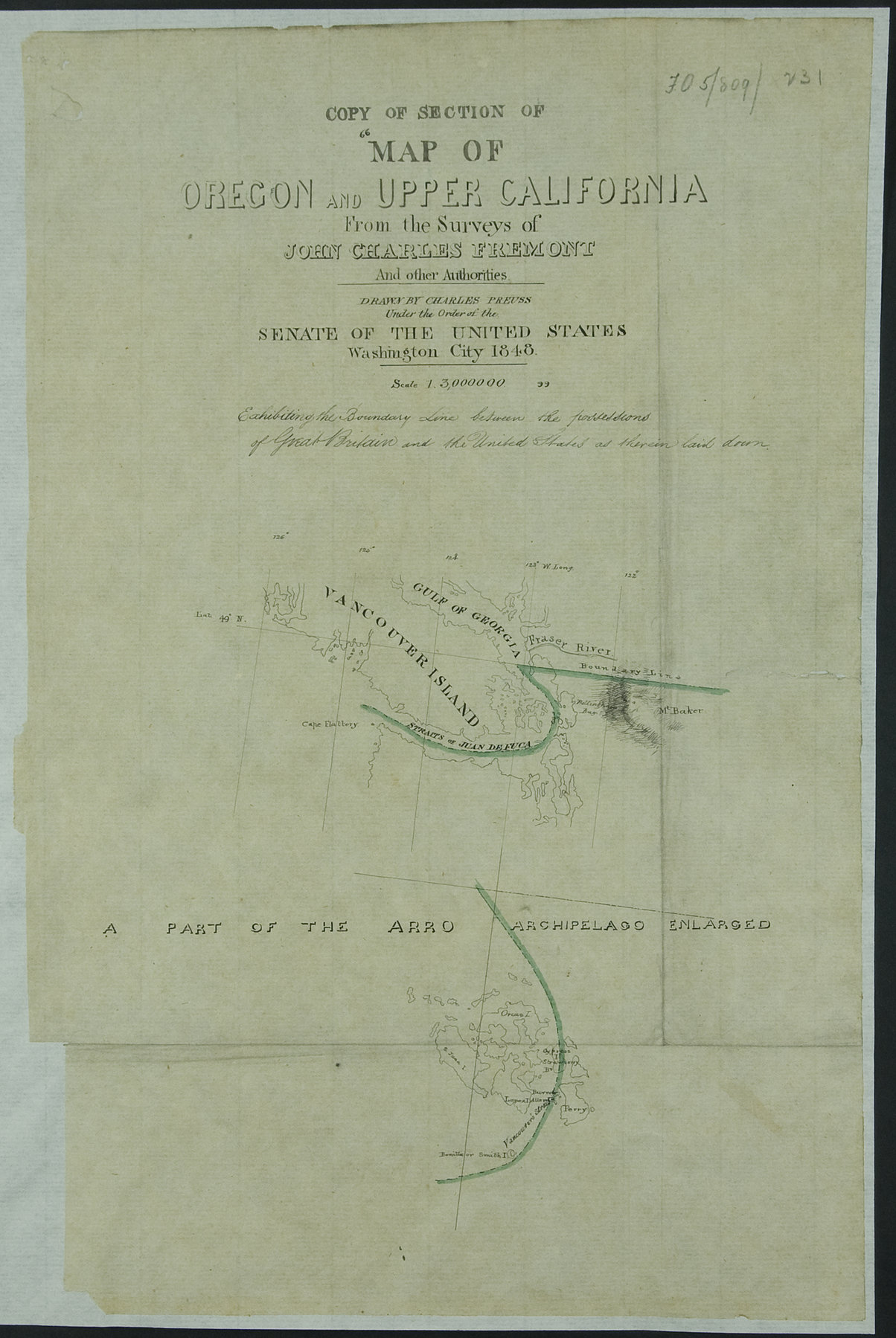
Copy of Section of ""Map of Oregon and Upper California From the Surveys of John Charles Fremont and other Authorities.
Map of Oregon and Upper California From the Surveys of John Charles Fremont And other Authorities. Drawn by Charles Preuss Under the Order of the Senate of the United States Washington City 1848. Scale 1.3,000000Exhibiting the Boundary Line between the possessions of Great Britain and the United States as therein laid down'. Shows boundary through the Strait of Juan de Fuca and through the Arro Archipelago (Vancouver's Strait). Extracted from Colonial Office letter of 20 February 1854. Does not show any territory in the United States.
Exhibiting the Boundary Line between the possessions of Great Britain and the United States as therein laid down.
Title: Copy of Section of ""Map of Oregon and Upper California From the Surveys of John Charles Fremont and other Authorities.
Title: Map of Oregon and Upper California From the Surveys of John Charles Fremont And other Authorities.
Author: Preuss, Charles, 1803-1854
Subject: United States -- Boundaries -- Maps; Canada -- Boundaries -- Maps; North American Boundary Commission.
Identifier (repository): MPK
Identifier (repoNumber): 1
Identifier (repoVol): 77
Identifier (libFileName): MPK1-77 (8)
Identifier (penfoldNum):
Identifier (doc_id): MPK 1/77/8
Date: 1854
Funder: Funded by a Canadian Council of Archives, Archival Community Digitization Program.
Publisher: National Archives of the UK.
49N/126W-122W