Colonial Despatches
The colonial despatches of Vancouver Island and British Columbia 1846-1871
Map of North America.
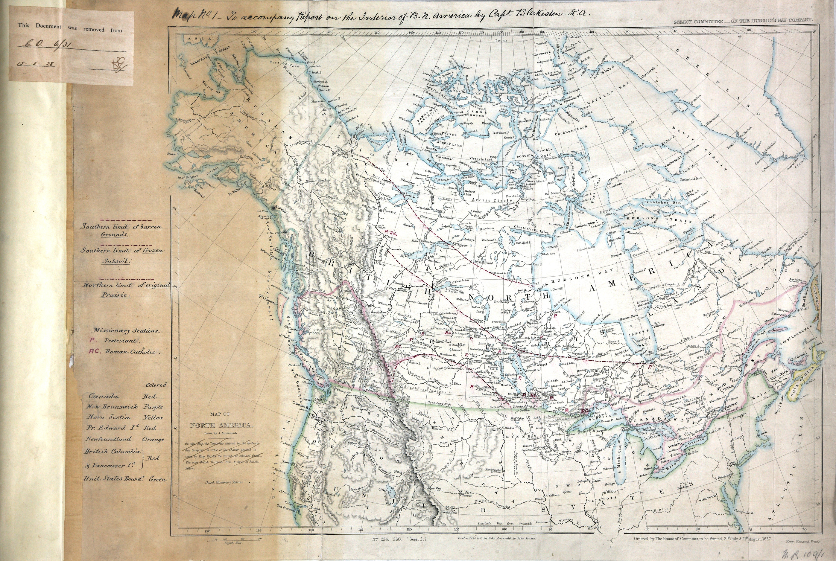
North America. Map showing lands belonging to Great Britain, Russia, the United States
of America, and the Hudson's Bay Company. Scale: 1 inch to about 180 miles. By J Arrowsmith;
ordered by the House of Commons to be printed, 31 July and 11 August, 1857. Henry
Hansard, Printer. MS additions, coloured, highlighting boundaries and showing the
southern limits of barren ground and ground with frozen subsoil, the northern limit
of original prairie, and the sites of Roman Catholic and Protestant mission stations;
MS reference table. In upper right margin: Select Committee--on the Hudson's Bay Company.
In lower margin: No.s 224. 260. (Sess. 2.). Relief shown by hachures.
Text at top of map: map no. 1: to accompany report on the interior of B. N. America
by Capt. Blakiston, R.A.
Arrowsmith, John, 1790-1873., Map of North America, 1857, John Arrowsmith, MR 1/109/1. The Colonial Despatches of Vancouver Island and British Columbia 1846-1871, Edition 2.6, ed. James Hendrickson and the Colonial Despatches project. Victoria,
B.C.: University of Victoria. https://bcgenesis.uvic.ca/mr_1-109-1_1857_north_america.html.
Title: Map of North America.
Author: Arrowsmith, John, 1790-1873.
Subject: Canada -- Maps; Alaska -- Maps; North America -- Maps; Hudson's Bay Company; British North American Exploring Expedition
Identifier (repository): MR
Identifier (repoNumber): 1
Identifier (repoVol): 1091
Identifier (libFileName): MR1-109-1
Identifier (penfoldNum):
Identifier (doc_id): MR 1/109/1
Date: 1857
Funder: Funded by a Canadian Council of Archives, Archival Community Digitization Program.
Publisher: John Arrowsmith
Publisher: National Archives of the UK.
65N-35N/130W-70W