Colonial Despatches
The colonial despatches of Vancouver Island and British Columbia 1846-1871
Haro Strait and Middle Channel.
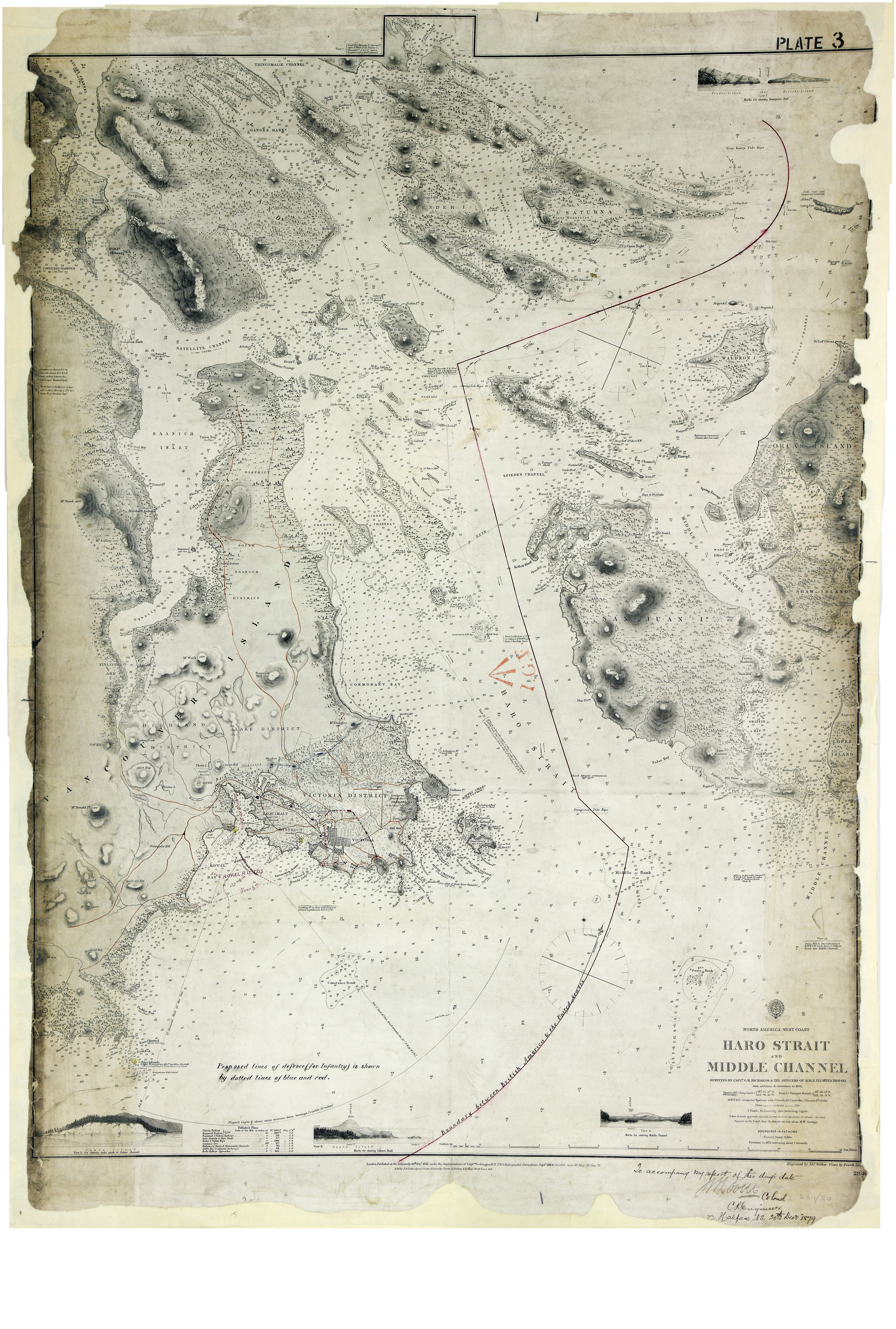
Vancouver Island (subsequently part of British Columbia, now in Canada); United States
of America: Washington Territory. 'North America West Coast. Haro Strait and Middle
Channel surveyed by Capt. G. H. Richards & the Officers of H.M.S. Plumper 1858-60…'.
Scale: 1 inch to 1 nautical mile. Compass roses. Published by the Admiralty, 26 November
1861; corrected to 1876. Insets: four views of the coast. Coloured MS additions show
proposed defence lines and the boundary between British and American territory. [Haro
Strait and Middle Channel, 1860; 1876; 1879]
To accompany my report of this day's date, J.B. Lovell, Colonel C. R. Engineer, Halifax,
N.S. 20th December 1879
Richards, G. H. (George Henry), Haro Strait and Middle Channel, 1861, Great Britain, Hydrographic Office, WO 78/2311/18. The Colonial Despatches of Vancouver Island and British Columbia 1846-1871, Edition 2.6, ed. James Hendrickson and the Colonial Despatches project. Victoria,
B.C.: University of Victoria. https://bcgenesis.uvic.ca/wo_78-2311_18_haro_s_1861.html.
Title: Haro Strait and Middle Channel.
Author: Richards, G. H. (George Henry)
Subject: Haro Strait (B.C. and Wash.)--Maps ; Nautical charts – Haro Strait (B.C. and Wash.) ; Victoria (B.C.)--Maps
Subject: Haro Strait and Middle Channel, 1860, 1876, 1879
Identifier (repository): WO
Identifier (repoNumber): 78
Identifier (repoVol): 2311
Identifier (libFileName): WO78-2311 (18)
Identifier (penfoldNum): 480
Identifier (doc_id): WO 78/2311/18
Date: 1861
Funder: Funded by a Canadian Council of Archives, Archival Community Digitization Program.
Publisher: Great Britain, Hydrographic Office
Publisher: National Archives of the UK.