Colonial Despatches
The colonial despatches of Vancouver Island and British Columbia 1846-1871
Nanaimo Harbour.
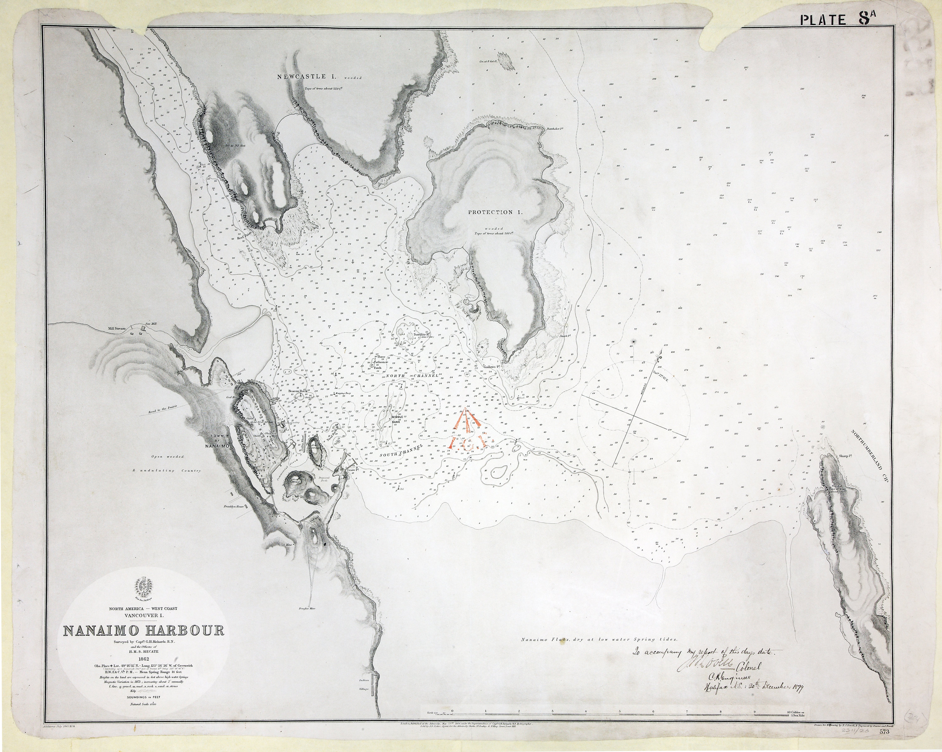
Vancouver Island (subsequently part of British Columbia, now in Canada). Chart: 'Nanaimo
Harbour Surveyed by Capt. G. H. Richards, R.N., and the Officers of H.M.S. Hecate
1862…'. Compass rose. Drawn for engraving by E J Powell; engraved by Davies and Powell;
published at the Admiralty, 23 May 1864; corrected to 1878. [Nanaimo, 1864; 1878;
1879]
To accompany my report of this day's date, J.B. Lovell, Colonel C. R. Engineer, Halifax,
N.S. 20th December 1879
Richards, G. H., Nanaimo Harbour, 1864, Great Britain, Hydrographic Office, WO78-2311 (24). The Colonial Despatches of Vancouver Island and British Columbia 1846-1871, Edition 2.6, ed. James Hendrickson and the Colonial Despatches project. Victoria,
B.C.: University of Victoria. https://bcgenesis.uvic.ca/wo_78-2311_24_nanaimo_harbour_1864.html.
Title: Nanaimo Harbour.
Author: Richards, G. H.
Subject: Nanaimo (B.C.)--Maps ; Nautical charts--British Columbia ; Nanaimo (B.C.)--Harbor
Subject: Nanaimo, 1864, 1878, 1879
Identifier (repository): WO
Identifier (repoNumber): 78
Identifier (repoVol): 2311
Identifier (libFileName): WO78-2311 (24)
Identifier (penfoldNum): 532
Identifier (doc_id): WO78-2311 (24)
Date: 1864
Funder: Funded by a Canadian Council of Archives, Archival Community Digitization Program.
Publisher: Great Britain, Hydrographic Office
Publisher: National Archives of the UK.
49 10'